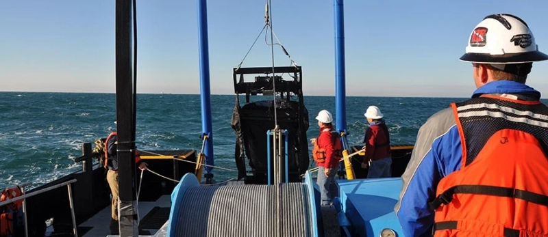
Ocean surveying generally refers to the measurement and description of the physical features of the oceans or water bodies and the prediction of their change over time. In practice, it isn\'t easy to define ocean surveying. Some definitions include a survey of the major navigable waters. In this blog, we will be talking about ocean survey equipment and techniques.

Studying Sea/Ocean With Acoustic Doppler Current Profiler
An acoustic Doppler current profiler captures sound waves under the deep blue, measuring the currents\' speed and direction throughout the water column. This study provides important information about the ocean\'s biological, chemical, and physical properties.
Ocean Survey Equipment And Technology Used In Ocean Surveying
Ocean survey equipment helps ship navigation by providing the possible pathways that the vessel can take. Certain ocean routes may be shallow or have rock and coal deposits. This poses a significant risk to ships and must therefore be properly recorded.
Here is a glimpse of the equipment needed for ocean surveys:
1. Acoustic Doppler Current Profiler
An acoustic Doppler current profiler uses sound waves to measure the speed and direction of currents in the water column. It measures how fast the water currents move across the water column. If anchored to the seafloor, it can measure water currents at the bottom and equal intervals up to the surface. It can also be mounted horizontally on the seabed to measure the current profile from one side of the shore to the other.
The working principle of the acoustic Doppler current profiler is based on the Doppler effect of the sound waves. An acoustic Doppler current profiler can measure small-scale water currents. Besides, it measures a water column up to 1000 m long.
2. Echosounders
They are a class of sonars that determine the depth of the water bodies mounted on the ship\'s bottom. They use sound pulses/beams to measure the depth of any water body. The depth of any water body can be measured by measuring the time lag between the transmitted sound beam and the received signal. Sound pulses are sent from the transducer to the bottom of the sea. The sound is reflected by the seafloor and returns to the transducer.
The time the sound takes to travel to the bottom and back helps calculate the distance to the seafloor.
Echosounders are of two types – single beam echo sounders and multiple beam echo sounders.
3. Side-scan sonars
Side Scan Sonars are ocean survey equipment used to image large areas of the seafloor at once. It is used mainly for navigation and detecting dangerous underwater terrain. They are used for conducting surveys for marine archaeology. The imagery is also used to detect debris and other obstructions on the seafloor that may be hazardous to shipping or oil and gas industry seafloor installations. A side-scan sonar uses high-frequency sound pulses bounced off by the seafloor and creates a seafloor morphology image. These images show differences in seabed texture and substrate types.
4. Light detection and ranging, LiDAR
Using the light pulses, light detection and ranging device or LiDAR analyses the bottom of the seabed. With the help of the lasers, a 3D image of the ocean\'s topography can be obtained. The LiDAR device is mainly used for dredging measurements and correctly positioning underwater pipelines.
5. Global Positioning System
To determine the precise location of the sounding boat on which the equipment is loaded, a Global Positioning System (GPS) is used. This ensures that the ship stays on a path known as a sounding line. Modern GPS advancements have enabled the sounding vessel to be completely automated.
6. Weather buoys
Ocean survey equipment Weather buoys collect weather and ocean data in the world\'s oceans while also assisting in emergency response to chemical spills, legal proceedings, and engineering design.
7. Buoys
Buoys are used as markers to indicate the path taken for sounding. This line must remain perpendicular to the shoreline at all times. Nowadays, buoys have been replaced by Global Positioning System.

Conclusion
Besides acoustic doppler current profiler, there are numerous pieces of equipment that help in the study of ocean/sea, and each one plays a vital role.
Ocean surveying is used to determine the features of the underwater area. The characteristics to be studied include water depth, topography features, tide measurement, etc. Surveying is also done to plan the construction of dams, docks, and harbors. It also aids in planning the flood control systems. It does so by predicting the possible flood zones and suggesting measures to counter them.
Read More - What Should You Look For While Choosing The Right Rov Lights?


