

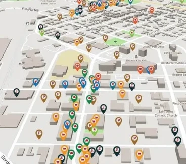
Interactive maps have become indispensable tools in our digital age, transforming the way we explore and understand geographic information. Unlike traditional static maps, interactive maps provide a dynamic and engaging user experience by allowing users to manipulate and interact with the displayed data.
At their core, interactive maps are digital representations of geographical information that can be accessed and explored through various digital devices such as computers, tablets, and smartphones. These maps offer a wide range of functionalities, empowering users to zoom in and out, pan across different areas, and overlay multiple layers of data for a more comprehensive view.
The key feature of interactive maps is their responsiveness to user inputs. Users can click on specific points of interest, access additional information, and customize the display based on their preferences. This interactivity not only enhances user engagement but also facilitates a more personalized and informative exploration of the mapped content.
Interactive maps find applications in diverse fields, from education and tourism to business and emergency services. In education, these maps serve as interactive learning tools, providing students with a dynamic platform to explore geographical concepts and historical events. In the business realm, they aid in market analysis, site selection, and location-based marketing strategies.
Technologically, the development of interactive maps involves the use of web mapping libraries, Geographic Information System (GIS) software, and data visualization techniques. These tools collectively contribute to creating responsive and feature-rich map interfaces that can be seamlessly integrated into websites and applications.
As technology continues to advance, we can expect even more sophisticated and innovative features to be integrated into interactive maps, further expanding their utility and impact. From navigating city streets to understanding complex spatial relationships in various industries, interactive maps are at the forefront of transforming how we visualize and interact with geographic information.