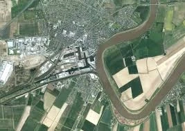
Transportation systems are the lifelines of cities and regions, connecting people, goods, and services. Geospatial data solutions are playing an increasingly vital role in optimizing transportation networks, improving mobility, and enhancing efficiency. By leveraging location intelligence, real-time data, and advanced analytics, these solutions empower transportation authorities and planners to make informed decisions, optimize routes, manage traffic flow, and provide better transportation services. This article explores the transformative impact of geospatial data solutions in transportation, highlighting how they enhance mobility and efficiency for the benefit of individuals and society as a whole.
Real-Time Traffic Monitoring and Management:
Geospatial data solutions enable real-time traffic monitoring and management, revolutionizing how transportation systems operate. By integrating data from various sources, including traffic sensors, GPS devices, and mobile apps, transportation authorities can gain insights into traffic patterns, congestion hotspots, and travel times. This real-time information allows for dynamic traffic management, enabling authorities to implement congestion reduction strategies, optimize signal timings, and reroute traffic when necessary. By proactively managing traffic, geospatial data solutions reduce delays, improve travel times, and enhance overall mobility.
Intelligent Routing and Navigation:
Geospatial data solutions empower intelligent routing and navigation systems that optimize travel routes and reduce congestion. By leveraging historical and real-time traffic data, these solutions can calculate the most efficient routes for drivers, considering factors such as traffic conditions, road closures, and real-time incidents. Intelligent routing and navigation systems help drivers avoid congested areas, improve travel efficiency, and minimize fuel consumption. Additionally, they enable transportation authorities to distribute traffic more evenly across road networks, leading to reduced congestion and improved overall system performance.
Public Transit Optimization:
Geospatial data solutions enhance the efficiency and effectiveness of public transit systems. By integrating geospatial data with transit schedules, ridership data, and real-time updates, transportation authorities can optimize bus and train routes, improve scheduling, and provide accurate arrival and departure information to passengers. Geospatial data solutions enable the identification of transit deserts or underserved areas, facilitating better allocation of resources and the expansion of transit services where they are most needed. These solutions also support multimodal integration, allowing users to plan trips that combine different modes of transportation seamlessly.
Demand-Responsive Transportation:
Geospatial data solutions facilitate the implementation of demand-responsive transportation services, such as ride-sharing or micro-transit systems. By analyzing geospatial data on passenger demand, transportation providers can dynamically adjust routes and schedules to match the real-time needs of passengers. Geospatial data solutions enable efficient allocation of vehicles, optimize pick-up and drop-off locations, and improve overall service reliability. Demand-responsive transportation services powered by geospatial data solutions offer flexible and personalized mobility options, reducing the reliance on private vehicles and enhancing overall transportation efficiency.
Infrastructure Planning and Maintenance:
Geospatial data solutions support infrastructure planning and maintenance in transportation systems. By integrating geospatial data with information on road conditions, bridge structures, and maintenance schedules, transportation authorities can identify critical infrastructure needs and prioritize maintenance and repair efforts. Geospatial data solutions enable the visualization and analysis of infrastructure data, facilitating proactive maintenance strategies, minimizing disruptions, and ensuring the safety and reliability of transportation networks.
Transportation Demand Management:
Geospatial data solutions contribute to effective transportation demand management strategies. By analyzing geospatial data on commuting patterns, population density, and travel behavior, transportation planners can develop targeted initiatives to reduce single-occupancy vehicle trips, promote carpooling, and encourage the use of alternative modes of transportation. Geospatial data solutions provide valuable insights for designing efficient transit routes, identifying ideal locations for bike-sharing or scooter-sharing stations, and implementing congestion pricing strategies. These initiatives result in reduced traffic congestion, improved air quality, and enhanced overall transportation sustainability.
Conclusion:
Geospatial data solutions are revolutionizing the transportation sector by enhancing mobility and improving efficiency. By leveraging location intelligence, real-time data, and advanced analytics, these solutions enable real-time traffic monitoring, intelligent routing, optimized public transit systems, demand-responsive transportation services, infrastructure planning, and transportation demand management. The integration of geospatial data solutions in transportation leads to reduced congestion, improved travel times, increased use of sustainable transportation modes, and enhanced overall mobility for individuals and communities. As the transportation landscape continues to evolve, geospatial data solutions will play an increasingly vital role in shaping smarter, more efficient, and sustainable transportation systems.


