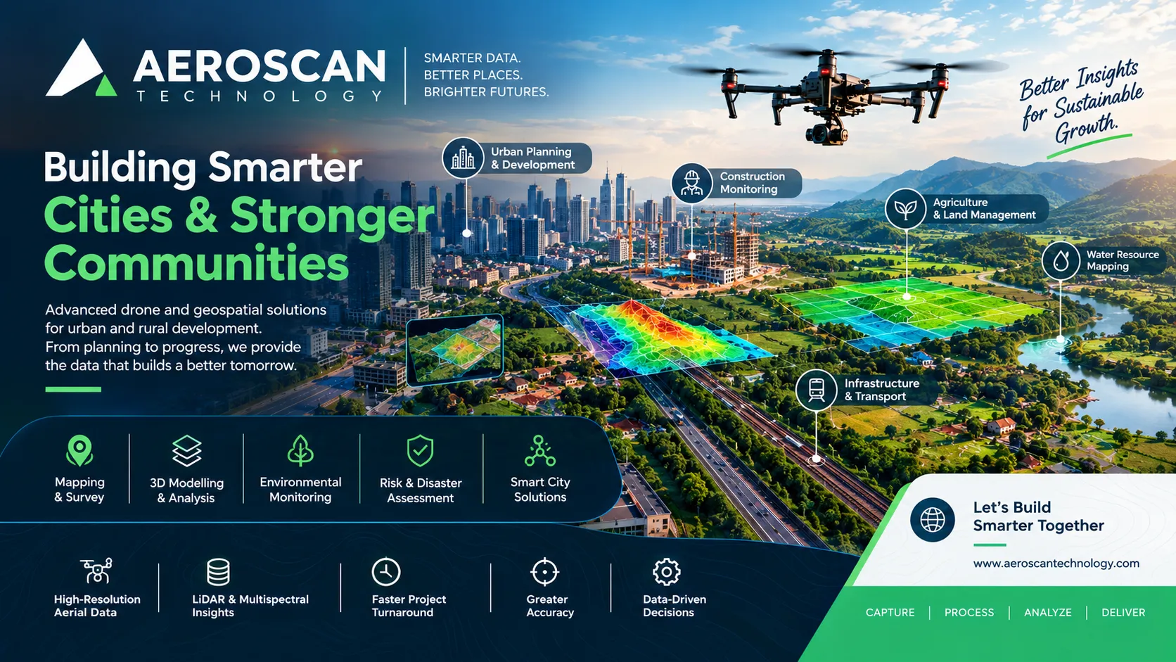

Cities are expanding, villages are developing, and the pressure on land and infrastructure is increasing every year. At the same time, planners and project teams need accurate information before making decisions about construction, transportation, water resources, public infrastructure, and land use. This is where drone-based urban and rural development solutions are becoming increasingly valuable. Instead of depending only on conventional ground surveys, development teams can now collect detailed aerial information and convert it into maps, models, measurements, and practical insights for better planning.
Development Planning begins with Better Information
A development project can look straightforward on paper, but the actual landscape often tells a different story. Land elevation may vary, existing structures may affect construction plans, drainage patterns may not be obvious from the ground, and the surrounding area can change rapidly.
For urban planners, this information is important when studying land use, zoning possibilities, infrastructure requirements, and future development. In rural areas, the same type of information can help with agricultural land management, road development, water resources, forestry, and rural construction.
Aerial surveys provide a broader view of the site while retaining detailed spatial information. Instead of collecting isolated measurements at selected points, project teams can obtain a more complete picture of the area and use that information for planning and monitoring.
This approach becomes especially useful when a project covers a large or difficult-to-access area.
Understanding Cities from Above
Urban development involves much more than constructing buildings. A city is a connected system of roads, public utilities, residential areas, commercial zones, open spaces, drainage networks, transportation routes, and public services.
When planners have accurate information about the existing landscape, they can make more informed decisions about how an area should develop.
Drone-based mapping can support the study of:
- Existing land use
- Topography and elevation
- Development potential
- Construction activity
- Infrastructure conditions
- Traffic movement
- Public spaces
- Areas requiring further inspection
Aeroscan Technology's urban development capabilities use LiDAR, RGB and multispectral data for mapping and analysing topography, land use and development potential. This type of information can support zoning decisions and more sustainable urban planning.
The advantage is not simply having aerial photographs. The real value comes from converting captured data into usable spatial information that planners and decision-makers can work with.
Making Construction Monitoring More Practical
Large construction projects rarely remain exactly on schedule. Material movement, changing site conditions, design modifications and unexpected issues can influence progress.
Regular aerial surveys can provide an updated view of a construction site without requiring teams to physically inspect every section of the project.
For example, aerial monitoring can help project teams understand whether work is progressing as planned, identify areas that require attention and document development over time.
Another useful application is volumetric analysis of material stockpiles. Instead of estimating the amount of material visually, aerial data can help create measurements that support better material planning.
This can be valuable for urban construction projects where multiple materials are stored across different areas of a site.
Regular monitoring also creates a record of project development. Comparing information from different survey periods can help teams understand what has changed and where additional action may be required.
Looking Beyond Buildings: Urban Infrastructure Inspection
Buildings are only one part of a city's infrastructure.
Bridges, public utilities and other structures need regular inspection to understand their condition and identify potential problems. Some areas are difficult or unsafe to inspect manually, particularly structures with restricted access or locations where reaching certain sections requires additional equipment.
Drone-based inspections can provide detailed visual information while reducing the need for extensive manual access.
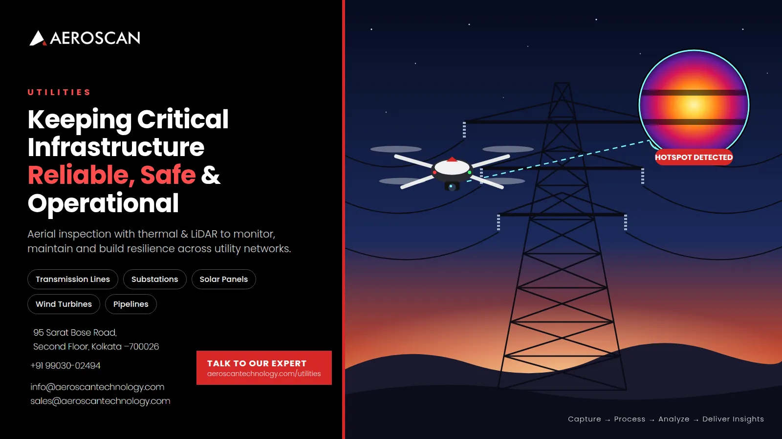
Thermal imaging adds another layer of information. Standard imagery shows visible conditions, while thermal data can help identify issues such as:
- Water leakage
- Insulation failures
- Overheating components
- Abnormal heat patterns
This can make aerial inspection useful not only for identifying visible damage but also for finding conditions that may not be obvious during a conventional visual inspection.
The objective is not to replace engineering judgement. Instead, aerial data can help inspection teams identify areas that deserve closer attention.
Traffic, Congestion and Public Safety
As cities become more crowded, traffic management becomes an important part of urban planning.
Ground-level observations provide information about individual roads or intersections, but aerial monitoring can offer a wider perspective of traffic movement.
Drone-based monitoring can help teams observe congestion patterns, understand movement around particular locations and support accident analysis. This information can be useful when authorities or planners are evaluating areas where traffic management needs improvement.
Public safety is another important consideration. Aerial surveillance can provide situational awareness over areas where large crowds, traffic incidents or infrastructure-related concerns require monitoring.
The benefit comes from having a broader visual perspective that can complement existing traffic and public-safety systems.
Supporting the Idea of a Smarter City
The concept of a smart city depends heavily on data.
Waste management, energy efficiency, public services, infrastructure monitoring and urban planning all require information that is accurate enough to support practical decisions.
Aerial and geospatial data can become one part of this larger information system.
For example, terrain and spatial data can support the planning of public infrastructure. Regular monitoring can help identify changes. Spatial information can also be combined with other datasets to understand how different parts of a city are developing.
This makes drone surveying more than a photography exercise. When properly processed, aerial data becomes a useful input for digital planning and urban decision-making. Aeroscan specifically identifies smart-city data support as an application for terrain and spatial data collection, including waste management, energy efficiency and monitoring of public services.
Rural Development Has a Different Set of Challenges
Urban areas usually have dense infrastructure and a large number of interconnected activities. Rural landscapes present a different challenge.
Development areas can be geographically spread out, roads may be difficult to access, agricultural land can cover large distances, and water resources may extend across multiple locations.
In these environments, traditional ground-based surveys can become time-consuming, especially when information needs to be collected repeatedly.
Aerial mapping can provide a broader view of rural land while helping teams focus their fieldwork where it is actually required.
This is particularly relevant for agricultural land management, rural infrastructure, water resources and land reclamation.
Mapping Land and Crop Areas
Rural development often starts with understanding the land itself.
Knowing where agricultural areas are located, how different crop zones are distributed and where soil variability exists can support better planning and resource allocation.
Aerial mapping can help create a clearer picture of farms, rural estates and surrounding land. The information can then support decisions related to crop management, land planning and future development.
Instead of treating a large rural area as one uniform landscape, mapping can help reveal differences across individual zones.
This can be particularly useful when development decisions need to balance agricultural activity with infrastructure requirements.
Rural Roads and Bridges Need Attention Too
Infrastructure development should not stop at city boundaries.
Rural roads and bridges are essential for connecting villages, farms, markets, public services and nearby towns. However, inspecting these structures can sometimes be difficult because of distance, terrain or limited accessibility.
Drone-based assessments can help identify visible damage or wear and reduce the need for inspectors to physically access every difficult location.
Aerial imagery can provide documentation that can be reviewed by technical teams and compared with later surveys.
This can make monitoring more systematic and help teams identify locations that require detailed ground inspection or maintenance.
Water Resources Are a Development Priority
Water management is another area where aerial monitoring can provide valuable information.
Reservoirs, rivers and canals can cover significant distances, making regular ground-level monitoring challenging. Changes in water conditions, drainage, erosion or surrounding land can also affect rural communities and infrastructure.
Aerial surveys can help monitor these areas and support activities such as:
- Flood-control planning
- Water distribution monitoring
- Reservoir assessment
- River and canal monitoring
- Identification of areas requiring attention
Early identification of problems can help prevent small issues from becoming larger infrastructure or resource-management challenges.
For rural regions where water security directly affects communities and agriculture, having updated spatial information can support more informed planning.
Watching Land Degradation and Forest Changes
Land does not remain unchanged.
Deforestation, erosion and land degradation can gradually alter rural landscapes. Some changes may be difficult to understand through occasional ground inspections because they develop over large areas and over extended periods.
Aerial data provides an opportunity to monitor these changes over time.
By comparing surveys from different periods, development and environmental teams can identify changes in land condition and focus attention on vulnerable areas.
This can support:
- Reforestation planning
- Land reclamation
- Erosion monitoring
- Deforestation tracking
- Long-term land management
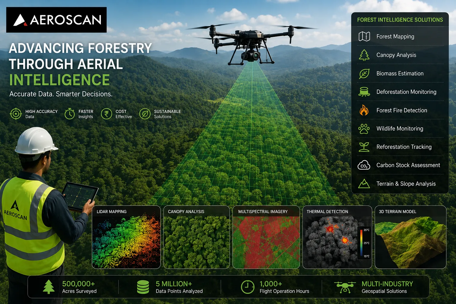
The same principle is useful for forestry-related monitoring, where understanding changes across a landscape can support more informed conservation and development decisions.
Rural Construction Needs the Same Level of Planning
Housing and infrastructure projects are also expanding into rural areas.
Before and during construction, project teams need information about land conditions, existing infrastructure and available space. Aerial surveys can assist with site assessment and ongoing monitoring.
Volumetric analysis can also support material planning by helping project teams understand stockpile quantities.
For future expansion, updated spatial information can provide a useful reference for deciding how available land can be utilised.
This is particularly useful when development takes place across large rural sites where frequent manual surveying would require considerable time and resources.
The Technology Behind the Information
The usefulness of drone surveying depends heavily on the sensors and processing methods used.
Different development projects may require different types of information.
RGB sensors can provide high-resolution visual imagery for mapping, inspection and 3D modelling.
LiDAR can capture detailed terrain and structural information and generate point clouds that are useful for terrain modelling and urban planning.
Thermal sensors detect heat patterns and can help identify leakage, insulation problems and overheating components.
Multispectral and hyperspectral sensors capture information beyond standard visible imagery and can support environmental, vegetation and land analysis.
Aeroscan also lists GPR for subsurface sensing and satellite imagery integration for larger-area spatial context.
The important point is that no single sensor is ideal for every project. The required payload depends on the landscape, project objective and type of information needed.
From Drone Flight to Development Decision
Collecting aerial imagery is only the first step.
A useful development solution needs to convert raw data into something that project teams can understand and use.
Aeroscan follows a four-stage workflow:
Capture → Process → Analyse → Deliver Insights
The captured drone and sensor data is processed into maps, models and reports aligned with development and infrastructure requirements.
This workflow creates a clear connection between technology and decision-making.
The drone collects information. Processing turns that information into usable datasets. Analysis helps identify patterns or areas requiring attention. Finally, the results are delivered in a format that supports planning and action.
That final step is particularly important. A technically impressive dataset has limited value if the people responsible for a project cannot use it effectively.
Why This Approach Matters for Future Development
Urban and rural development will continue to become more data-driven.
Planners need to understand changing land conditions. Construction teams need better progress visibility. Infrastructure managers need efficient inspection methods. Rural authorities need information about roads, water resources and land. Environmental teams need ways to monitor changes over time.
Aerial and geospatial technologies can contribute to all of these areas.
According to Aeroscan's urban and rural development page, the approach is designed to support informed planning, efficient infrastructure monitoring, reduced dependence on manual surveys, early identification of risks and savings compared with traditional methods.
The biggest advantage may therefore be the ability to make decisions using a more complete picture of the environment.
What Development Teams Should Look For
Choosing a drone service provider should not be based simply on whether a company operates drones.
The more important question is what happens with the data after the flight.
A capable provider should understand surveying, mapping, sensors, GIS processing and the specific requirements of the project.
It should also be able to select appropriate technologies depending on whether the requirement involves terrain mapping, infrastructure inspection, vegetation monitoring, construction progress or water resources.
An end-to-end approach can make the process easier because data capture, processing and analysis remain connected rather than becoming separate activities handled by unrelated teams.
Aeroscan describes its broader approach as combining drone technology, advanced sensors, geospatial intelligence and AI-assisted analysis to deliver actionable information across multiple industries.
A More Connected Way to Plan Development
The future of development is not simply about building faster. It is about understanding an area before changing it.
A city needs to know where infrastructure pressure is increasing. A rural region needs to understand its land and water resources. A construction team needs to know whether progress matches expectations. An infrastructure manager needs early visibility into potential problems.
Aerial intelligence can connect these requirements by providing detailed spatial information from a wider perspective.
When that information is processed correctly, it becomes more than a collection of images. It becomes a foundation for planning, monitoring and making decisions with greater confidence.
Conclusion
Urban and rural development involve very different landscapes, but both depend on one fundamental requirement: reliable information before important decisions are made. From city zoning and construction monitoring to rural land management, water resources, roads, bridges, forestry and infrastructure development, drone-based surveying can provide a detailed view of areas that may otherwise be difficult or time-consuming to assess. When combined with LiDAR, RGB, thermal and multispectral technologies, aerial data can support better planning, faster monitoring and earlier identification of risks. As development becomes increasingly data-driven, geospatial intelligence for sustainable development can play an important role in helping planners, infrastructure teams and communities make better-informed decisions about the places they are building and managing.

























Sign in to leave a comment.