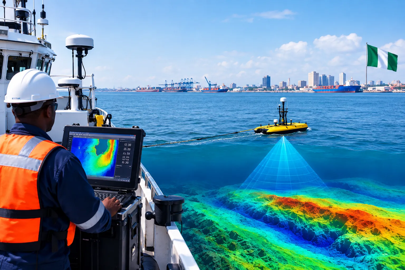

Offshore developments, port expansions, dredging projects, and subsea infrastructure all depend on knowing what lies beneath the water. A well-planned Hydrographic survey Nigeria campaigns gives project owners and engineering teams reliable information about water depths, seabed contours, underwater features, and other conditions that can influence marine construction and operations.
This becomes particularly important in Nigerian waters, where coastal channels, estuaries, and offshore areas can have very different seabed and water conditions.
Why Hydrographic Intelligence Matters
The marine environment around Nigeria is constantly changing. Estuarine areas in the Niger Delta can experience sediment movement and shifting channels, while offshore locations in the Gulf of Guinea may present different depths, slopes, and seabed features.
Historical charts can provide useful background information, but they may not reflect current local conditions. A detailed hydrographic survey provides project teams with updated information that can support decisions such as:
- Subsea route planning: Mapping seabed contours and potential obstacles along pipeline and cable corridors.
- Dredging assessment: Establishing existing depths and supporting pre- and post-dredge surveys.
- Marine construction: Providing accurate seabed information for the planning and positioning of offshore structures.
- Navigation: Supporting the assessment of channels, approaches, and areas where water depth is critical.
The earlier these conditions are understood, the easier it is for engineers to plan around them.
Technologies Behind Modern Hydrographic Surveys
Modern hydrographic campaigns combine acoustic measurement, positioning systems, and supporting marine sensors to build a detailed picture of the underwater environment.
Multibeam Echo Sounders
Multibeam Echo Sounders (MBES) use multiple acoustic beams to measure water depths across broad areas. The resulting bathymetric data can reveal seabed contours, slopes, channels, depressions, and other changes in underwater terrain.
For offshore construction and dredging projects, this information provides a reliable basis for understanding existing seabed levels.
Side-Scan Sonar
Side-scan sonar produces detailed acoustic imagery of the seabed surface. It can help identify features such as exposed pipelines, debris, rock outcrops, wrecks, and other anomalies that may require further investigation.
Where buried metallic objects or specific geophysical hazards are a concern, additional techniques such as marine magnetometry may be incorporated into the wider survey program.
Positioning and Oceanographic Measurements
Accurate positioning is essential because every depth measurement needs to be tied to the correct geographic location. Survey systems therefore combine high-precision positioning with motion sensors to account for vessel movement.
Depending on project requirements, ADCPs, tide gauges, and other oceanographic instruments may also be used to understand currents, water levels, and other marine conditions that can affect offshore operations.
Why Local Knowledge Still Matters
Technology does not remove the need for field experience. Survey conditions can vary considerably between Nigerian coastal and offshore locations.
Sediment transport, river discharge, tidal conditions, weather, water depth, and vessel access can all influence how a survey should be planned. The right approach therefore depends on the location and the engineering question the survey needs to answer.
A capable survey partner should be able to select appropriate methods, manage field acquisition, process the resulting datasets, and present the findings in a format that engineers and project managers can use.
GeoAlliance Ltd combines hydrographic survey capabilities with multidisciplinary marine survey expertise to support projects requiring reliable information about Nigerian coastal and offshore environments.
Final Thoughts
A hydrographic survey is more than a collection of depth measurements. It provides the current site information needed to understand an underwater environment before engineering and construction decisions are made.
For projects in Nigeria, combining suitable survey technology with careful planning, accurate positioning, quality-controlled data, and local marine knowledge can give project teams a much clearer picture of the conditions they will encounter. That clarity can be particularly valuable when the cost of discovering an underwater problem after construction has already begun is high.




















Sign in to leave a comment.