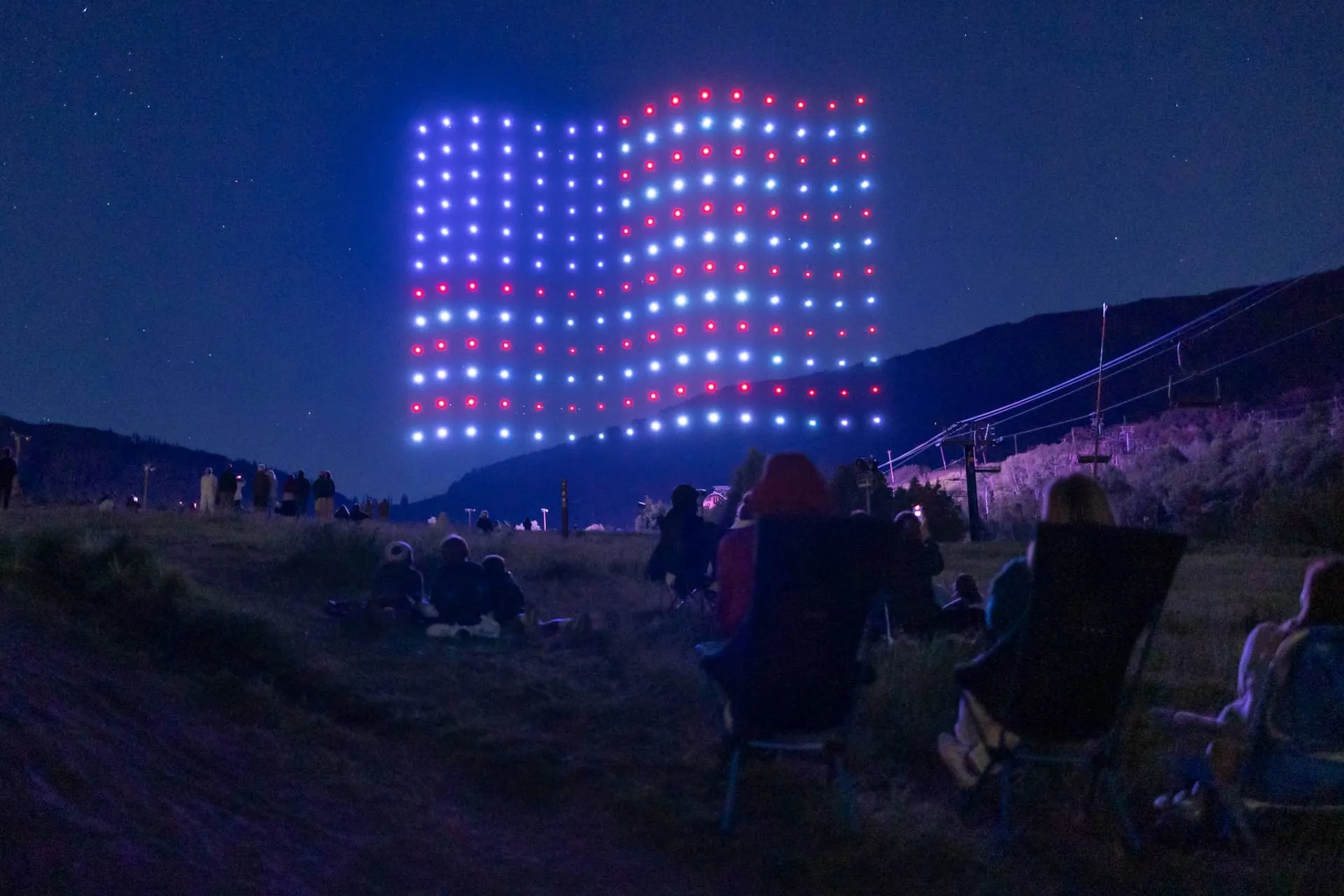

A synchronized aerial performance depends on every aircraft knowing where it is, where it needs to go, and whether it can safely continue its programmed flight. If GPS or another GNSS positioning source becomes unreliable during a performance, even a brief positioning error can affect a drone's ability to maintain its assigned trajectory. That is why professional Drone Light Shows are designed around detection, redundancy, geofencing, and predefined emergency responses rather than assuming GPS will always remain perfect.
The important point is that a GPS failure does not automatically mean a drone will immediately fall from the sky. The aircraft and show-control system are typically designed to detect positioning problems and execute a predetermined safety response.
What Happens When a Drone Loses GPS?
When GPS becomes unavailable or unreliable, the flight controller can no longer depend on accurate global-position information in the same way. The drone may temporarily rely on other onboard sensors, but the appropriate response depends on the system's design and the severity and duration of the positioning failure.
In a professional show environment, the system may:
- Detect that GNSS positioning is no longer valid.
- Compare positioning information with onboard sensor data.
- Trigger a programmed failsafe.
- Hold, abort, land, or execute another approved emergency procedure.
- Alert the show-control team so the performance can be safely managed.
The FAA has specifically documented drone-show operating requirements involving GPS or RTK positioning, geofencing, flight termination systems, and predefined abort actions. One FAA-approved show procedure states that if GPS or RTK signal is lost and cannot be re-established within the specified period, the show is held and the remote pilot in command lands the aircraft as safely as possible.
Why GPS Is So Important to a Drone Show
A conventional drone flight may involve one aircraft moving through relatively open airspace. A coordinated aerial performance is much more demanding because numerous aircraft must follow precisely planned trajectories while maintaining their positions relative to the overall formation.
GPS, or more broadly GNSS, can provide the position reference needed for this choreography. Some professional systems also use RTK corrections to improve positioning precision.
This becomes particularly important when drones are:
- Forming detailed shapes in the sky.
- Moving along closely coordinated trajectories.
- Changing altitude or formation.
- Performing synchronized movements with music.
- Operating inside a predefined performance volume.
A positioning error that might appear insignificant during an ordinary recreational flight can become much more important when multiple aircraft are flying predetermined paths near one another.
Does a Drone Immediately Fall When GPS Is Lost?
No. Losing GPS does not inherently mean immediate motor failure or a free fall.
A flight controller can continue receiving information from sensors such as inertial measurement units, barometers, and other navigation systems. Depending on the aircraft's architecture, these sensors can help maintain stability for a limited period.
However, maintaining attitude is different from maintaining precise global position.
A drone may remain airborne while its estimate of its horizontal position becomes increasingly uncertain. This distinction is critical: staying in the air and knowing exactly where the aircraft is are two different problems.
For this reason, professional show systems generally do not simply assume that a drone can continue its choreography indefinitely after GNSS becomes invalid.
What Failsafe Action Does the Drone Take?
There is no universal response for every drone show. The appropriate action depends on the aircraft, flight-control software, show-control architecture, operating approval, and programmed safety procedures.
Possible responses include:
- Holding: The aircraft temporarily maintains a safe state while the navigation issue is assessed.
- Show hold: The broader performance is paused while the system manages the affected aircraft.
- Return or recovery procedure: The aircraft follows a predefined route or recovery branch where supported.
- Controlled descent: The drone reduces altitude and lands in an approved area.
- Flight termination: In a serious failure, the system may use a dedicated termination procedure designed to prevent the aircraft from continuing outside its permitted operating area.
Professional systems can also combine multiple layers of protection. For example, Verge Aero's published safety documentation describes separate failsafe behaviors for invalid GNSS, controlled descent, flight termination, and performance-volume violations.
That layered approach is important because no single safety mechanism should have to carry the entire burden.
What Happens to the Other Drones?
This is where a professional show becomes more than a collection of individual aircraft.
A properly engineered system considers the possibility that one aircraft may experience a fault without allowing that problem to automatically become a fleet-wide emergency.
The affected drone may exit the choreography while the remaining aircraft continue, pause, or transition into another predefined flight plan. In some systems, the show-control architecture can select an alternative mission or recovery sequence.
The exact behavior varies considerably between platforms. Therefore, it would be misleading to claim that every fleet responds to GPS loss in exactly the same way.
The key principle is controlled failure: the system should know what to do when an individual aircraft can no longer safely perform its assigned task.
GPS Loss Is Not Always the Same as GPS Failure
A positioning problem can take several forms. The receiver might temporarily lose satellite visibility. It could experience interference, multipath effects, poor geometry, or another condition that makes the position estimate unreliable. A system may therefore monitor not only whether a GPS signal exists, but whether the resulting position is trustworthy.
This distinction matters in environments with tall buildings, reflective surfaces, or other sources of signal degradation. GNSS validity can be evaluated using receiver accuracy information and flight-controller estimation data rather than simply checking whether satellites are detected. In other words, having a signal does not necessarily mean having a safe navigation solution.
How RTK Can Improve Positioning
RTK, or Real-Time Kinematic positioning, can provide much greater positioning precision than conventional standalone GNSS when the required correction infrastructure and signal conditions are available.
This can be valuable during tightly choreographed performances because accurate positioning helps the aircraft follow its assigned trajectory more precisely.
However, RTK should not be treated as an unlimited safety solution.
An RTK-dependent system still needs procedures for:
- Loss of correction data.
- Degraded GNSS reception.
- Invalid positioning estimates.
- Communication failures.
- Sensor inconsistencies.
- Aircraft hardware failures.
FAA documentation for drone-show operations specifically references GPS that may be augmented by RTK and requires defined flight areas and show flight plans.
The lesson is straightforward: precision and redundancy work together; one does not replace the other.
How Professional Shows Prepare for GPS Loss
A safe performance begins long before the audience sees the first formation.
Professional operators can prepare by validating the aircraft, mission files, positioning systems, communications, geofences, emergency procedures, and surrounding operating environment.
Important preparation steps include:
- Checking GNSS and RTK performance before launch.
- Verifying the programmed flight paths.
- Establishing the approved performance volume.
- Testing failsafe behavior.
- Confirming emergency landing or recovery areas.
- Monitoring weather and environmental conditions.
- Reviewing communication and telemetry performance.
- Keeping appropriate personnel responsible for safety monitoring.
- Establishing clear abort criteria.
The FAA documentation for an approved drone-show operation illustrates this approach by requiring testing and verification of flight termination systems and defining thresholds for actions such as Return to Home, Return to Land, Show Hold, and Land Now.
This preparation is what separates a carefully engineered aerial production from simply putting multiple autonomous aircraft into the sky.
What Should the Audience Notice During a GPS Problem?
In many cases, the audience may notice very little. A well-designed show is intended to manage technical problems without creating unnecessary disruption or danger. A single aircraft may be removed from the formation, the choreography may change, or the entire performance may be paused if safety conditions require it.
The audience might see:
- A missing point in a formation.
- A temporary pause.
- A formation changing unexpectedly.
- A controlled landing outside the main performance area.
- A complete show cancellation or early conclusion.
These outcomes can actually indicate that the safety system is working as intended. Continuing a performance simply to preserve the visual effect would be the wrong priority.
Why Redundancy Matters in Drone Light Shows
GPS is only one part of the safety architecture. A professional aircraft can combine navigation information from multiple sensors and use software to identify inconsistencies. Some systems also incorporate independent safety mechanisms capable of ending a mission when the aircraft is no longer considered fit for automated flight.
This is particularly important because large formations create a more complex risk environment. A single aircraft leaving its intended trajectory can potentially affect nearby aircraft or the ground area below.
Research into multi-drone show failures has also highlighted the challenge of handling individual aircraft failures within dense formations, reinforcing the importance of predefined evacuation and failsafe strategies.
The goal is not to pretend that failures are impossible. The goal is to make failures predictable, detectable, and manageable.
What Should Event Organizers Ask Before Booking a Show?
Anyone planning an aerial performance should look beyond the visual quality of the demonstration.
A responsible organizer can ask the operator:
- What happens if a drone loses GNSS?
- What happens if RTK corrections are interrupted?
- What is the programmed response to an aircraft failure?
- Where are emergency landing areas located?
- How is the performance volume protected?
- What procedures are used if the entire show must be aborted?
- What weather conditions require cancellation?
- How are pre-show safety checks documented?
These questions help event organizers understand that the quality of a drone performance is not measured only by how impressive it looks.
The engineering behind the performance matters just as much.
Conclusion
A GPS failure during an aerial performance does not automatically mean that every drone will fall or that the entire event will become uncontrollable. What happens next depends on how the system detects the navigation problem and which failsafe procedures have been engineered, tested, and approved for that operation.
For audiences, the most useful takeaway is simple: the spectacular formation visible in the sky is only the final layer of a much larger technical system.
When evaluating a provider, event organizers should ask about GNSS and RTK redundancy, failsafe behavior, emergency landing procedures, geofencing, and show-abort protocols—not just the number of drones or the complexity of the animations.
A responsible operator should be able to explain what happens on a bad day, not only what happens when everything works perfectly. That mindset is essential for making Drone Light Shows both visually impressive and responsibly managed.
Frequently Asked Questions
1. Can a drone fly without GPS during a show?
A drone may remain airborne temporarily using other onboard sensors, but that does not necessarily mean it can safely continue its programmed choreography. If global positioning becomes invalid, the aircraft may trigger a predefined failsafe rather than continue the performance.
2. What happens if one drone loses GPS during a drone show?
The affected aircraft may enter a programmed recovery, holding, descent, or termination procedure, depending on the system. The remaining aircraft may continue, pause, or transition to another mission. The exact response is determined by the show's safety architecture and operating procedures.
3. Can RTK prevent GPS problems during a drone show?
RTK can improve positioning precision, but it does not make a system immune to navigation failures. RTK corrections and GNSS reception can still become unavailable or unreliable, so professional Drone Light Shows require appropriate backup and failsafe procedures.
4. Why do drone shows use geofencing?
Geofencing helps define the permitted operating area for the aircraft. It provides an additional safety boundary so that the flight system can detect when an aircraft approaches or leaves its approved performance volume. FAA documentation for approved operations specifically addresses GPS-based geofencing and defined flight areas.
5. Is drone light shows safe if GPS fails?
Safety depends on the aircraft, software, operator, approved procedures, and environmental conditions. A GPS failure should be treated as a serious navigation event, not something every system handles identically. Well-engineered Drone Light Shows use monitoring, predefined fail safes, geofencing, and emergency procedures to manage such failures.


















Sign in to leave a comment.