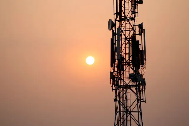

Cell tower location data provides a detailed view of cellular towers, cell sites, antennas, and wireless network distribution across geographic areas. By mapping these assets, businesses, network planners, consultants, and public agencies can better understand cellular infrastructure, identify potential coverage gaps, and make informed decisions about connectivity. Whether evaluating a new facility, planning network improvements, or comparing cellular service across a region, accurate location data helps turn complex infrastructure information into practical insights.
Why Cell Tower Location Data Matters
Reliable cellular connectivity is essential for businesses, communities, and individuals who depend on mobile devices for communication, navigation, and data access. However, understanding the infrastructure behind cellular service can be challenging without a clear view of tower locations and surrounding network assets.
Cell tower location data helps simplify this process by bringing important information into a single mapping environment. Teams can identify nearby towers, compare infrastructure across different areas, and evaluate potential connectivity challenges before committing to new projects.
A centralized view of cellular assets also improves collaboration between technical and business teams. Engineers can assess infrastructure requirements, property managers can investigate connectivity around their facilities, and decision-makers can prioritize investments based on geographic needs.
What Is Included in Cell Tower Location Data?
Cell tower location data typically consists of geographic points representing cellular towers and cell sites, accompanied by attributes that help users understand the infrastructure in a particular area.
Tower Locations and Site Information
Mapping tower locations makes it easier to identify cellular infrastructure within a city, region, or broader market. Depending on the available records, site attributes may include antenna information, ownership, tower height, elevation details, and general antenna orientation.
These details provide useful context for understanding how cellular infrastructure is distributed. Analysts can examine tower proximity to buildings, roads, commercial properties, and other important locations to identify potential opportunities for connectivity improvements.
Antennas and Network Configuration
Antennas play an important role in determining how cellular signals are transmitted and received. Their positioning, orientation, and operating characteristics influence the areas they can serve.
Cell tower location data can help planners review available antenna information and understand how individual sites relate to surrounding infrastructure. Where frequency-band information is available, including LTE or C-band context, it can also support preliminary assessments of network capabilities and deployment requirements.
Geographic Coverage and Proximity
Geographic analysis helps users determine which cellular assets are closest to a particular address or project location. By searching an address, entering coordinates, or selecting an area on a map, teams can identify nearby towers and compare possible options.
Distance measurements and orientation information can assist with preliminary evaluations of cellular connectivity. However, proximity alone does not guarantee strong reception. Terrain, buildings, obstructions, network configuration, interference, and operating frequencies can all affect actual signal performance.
Who Benefits From Cell Tower Location Data?
Network Operators and Cellular Providers
Cellular providers use infrastructure maps to evaluate existing networks, plan upgrades, and identify areas that may require additional capacity. Reviewing tower locations alongside small-cell infrastructure helps teams understand how network assets are distributed across a market.
This information can support deployment planning, infrastructure coordination, and preliminary assessments of locations where improved coverage or additional network resources may be needed. Combining tower data with fiber routes can also help planners evaluate potential backhaul connectivity for cellular sites.
Businesses and Commercial Property Owners
Businesses increasingly depend on reliable cellular connections for mobile devices, wireless equipment, communications systems, and operational applications. Before selecting a new office, warehouse, industrial property, or campus location, organizations may want to understand the surrounding cellular infrastructure.
Cell tower location data allows site selection teams to investigate nearby assets and identify locations that may require additional connectivity planning. Businesses can use these findings to guide discussions with cellular providers about indoor reception, signal distribution, and potential network improvements.
Public Agencies and Economic Development Teams
Local governments and public agencies need dependable communication infrastructure to support residents, emergency services, public facilities, and economic activity.
Mapping cellular towers helps agencies understand how infrastructure is distributed across communities. These insights can highlight areas that warrant further investigation, support connectivity assessments, and help organize conversations with service providers about potential improvements.
Consultants and Business Intelligence Teams
Telecommunications consultants and business intelligence professionals often combine infrastructure data with demographic, commercial, and geographic information to evaluate markets and support strategic decisions.
Cell tower location data can be incorporated into geographic information system (GIS) platforms, analytical dashboards, and site selection workflows. This allows consultants to compare infrastructure conditions across locations and communicate findings through clear maps and reports.
Common Applications of Cell Tower Location Data
Identifying the Nearest Cell Tower
Finding the nearest cell tower is a common starting point when investigating cellular connectivity at a specific location. An address-based search or coordinate lookup can reveal nearby towers and help users compare distances between candidate sites.
This information provides an initial understanding of the surrounding infrastructure. For a more complete assessment, users should also consider antenna orientation, terrain, building obstructions, frequency bands, and measured signal strength.
Evaluating Cellular Coverage Gaps
Coverage challenges can occur in rural communities, dense urban environments, industrial facilities, and areas with significant terrain changes. Tower maps help identify places where cellular infrastructure is sparse or where additional analysis may be necessary.
Teams can compare nearby tower distribution, examine available site attributes, and investigate whether a small cell, an indoor coverage system, or coordination with a network provider could address the issue.
Supporting Site Selection
Selecting a property for a business operation involves more than evaluating access, utilities, and transportation. Cellular connectivity can also be important, particularly for facilities that rely on wireless devices, remote monitoring, mobile communications, or connected equipment.
Reviewing cell tower locations during site selection helps organizations identify potential connectivity concerns before finalizing a property decision. The findings can then guide field testing and discussions with providers.
Planning Network Expansion
Network expansion requires a clear understanding of existing infrastructure and areas where demand may justify additional investment. Mapping towers and small cells allows planners to compare markets, identify clusters of existing assets, and shortlist locations for further engineering analysis.
When combined with customer demand, fiber availability, and geographic constraints, tower location data can contribute to a more informed deployment strategy.
How to Analyze Cell Tower Locations
Start With a Market Overview
Begin by reviewing tower and cell-site distribution across the target market. Identify areas with concentrated infrastructure, locations with fewer nearby assets, and corridors that may require closer examination.
Comparing different neighborhoods or regions provides an initial understanding of how cellular infrastructure is distributed. This broad assessment helps teams focus on the areas most relevant to their objectives.
Examine Specific Addresses
Once priority areas have been identified, evaluate individual addresses or project coordinates. Review the nearest tower candidates, compare their distances, and examine any available antenna orientation or frequency information.
For important sites, supplement the map with on-site signal measurements, provider coverage information, or a professional radio-frequency assessment. These additional checks help distinguish geographic proximity from actual service quality.
Prioritize Locations for Further Investigation
After reviewing the available information, organize candidate locations according to project requirements. Factors may include tower distance, surrounding infrastructure, potential line of sight, property characteristics, and the availability of supporting fiber connections.
Documenting these factors makes it easier to compare alternatives, explain recommendations, and coordinate next steps with engineering teams or service providers.
Integrating Cell Tower Data With GIS Platforms
Geographic information systems make it possible to combine cellular infrastructure with other spatial datasets. Rather than analyzing tower locations independently, teams can overlay cellular assets with roads, property boundaries, fiber routes, terrain, and commercial development areas.
This integrated approach provides a broader understanding of connectivity requirements. For example, a network planner evaluating a new cell site may need to consider both nearby towers and the availability of fiber infrastructure for backhaul. A property developer may compare cellular assets with building locations and planned construction.
Standard GIS formats also support analysis in established mapping applications, while browser-based platforms can make it easier for stakeholders to review maps, inspect available attributes, and export information for presentations or project documentation.

Related Telecommunications Infrastructure Data
Cell tower location data becomes more valuable when analyzed alongside other telecommunications datasets.
Carrier fiber routes provide information about the fiber infrastructure that may support cellular backhaul and network transport. Reviewing fiber routes alongside tower locations can help planners investigate connectivity options for potential sites.
Data center locations provide context about facilities where digital traffic is processed, stored, or interconnected. This information can contribute to broader infrastructure planning and regional connectivity analysis.
Broadband and wireless infrastructure data expands the view beyond cellular towers to include other network technologies. Combining these layers helps organizations evaluate connectivity across different access methods and infrastructure types.
Together, these datasets provide a more comprehensive perspective on telecommunications infrastructure and support better-informed decisions about network development and site selection.
Improving Decisions With Accurate Cell Tower Location Data
Cell tower location data helps organizations understand where cellular infrastructure exists, identify nearby towers, and investigate potential connectivity challenges. By bringing tower locations, antenna details, and geographic context into a consistent mapping environment, teams can evaluate sites more efficiently and prioritize areas that require additional attention.
From network expansion and commercial property selection to public infrastructure planning, accurate cellular asset information supports a more structured approach to connectivity decisions. When combined with field measurements, provider information, and complementary infrastructure datasets, it becomes a practical resource for evaluating network conditions and planning future improvements.

























Sign in to leave a comment.