
So, you’re planning a project in Toronto. Maybe it’s a sleek backyard studio, a tricky extension to your century-old home, or that dream deck you’ve been sketching on napkins. Or perhaps you’re an architect trying to figure out why nothing in this city seems flat.
Here’s the truth nobody tells you: Toronto’s ground has secrets. And if you don’t uncover them before you build, those secrets will cost you time, money, and a whole lot of Tylenol.
That’s where topographic survey services come in. But before you grab the first number off Google, let’s walk through what you actually need to know — no jargon, no fluff, just real talk.
First Things First: What Even Is a Topo Survey?
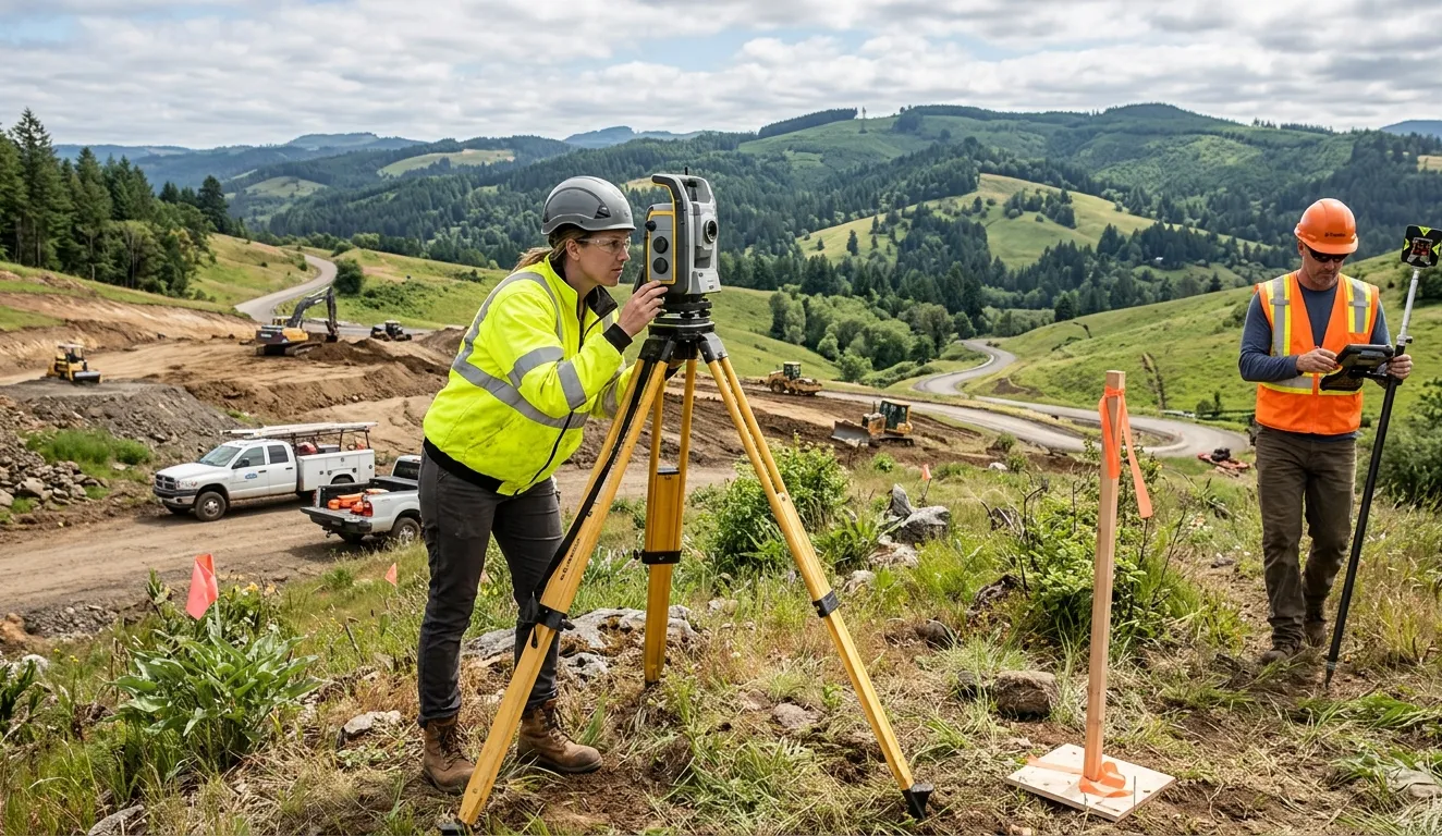
Imagine draining all the water, trees, and houses out of your property. What’s left? The bare earth — every bump, slope, dip, and hidden rise. A topographic survey (or “topo” for short) maps all of that. It shows existing features like curbs, manholes, retaining walls, and even the subtle slope that makes your driveway puddle like a kiddie pool every spring.
In Toronto, where ravines, clay soils, and stubborn tree roots play dirty, a topo survey is your map to sanity.
Why You Can’t Skip This (Even if You’re Just Thinking About Building)
Let me paint a picture. You hire a designer. They draw up gorgeous plans. The contractor shows up with a shovel — and hits a four-foot elevation change nobody saw coming. Suddenly your “simple” project needs retaining walls, extra drainage, and a prayer to the permit gods.
That’s not drama. That’s Toronto.
A proper topographic survey protects you from:
- Permit rejections (the city loves accurate elevation data)
- Costly change orders (surprises cost triple underground)
- Neighbour disputes (water runoff is real, folks)
- Design mistakes (your windows shouldn’t stare at a hill)
What a Pro Toronto Topo Survey Actually Shows You
A great surveyor doesn’t just measure. They translate the land into a language you and your architect can use. Expect to see:
- Contour lines (like a fingerprint of your land’s shape)
- Spot elevations at key points (corners, low spots, utility lids)
- Location of trees (especially those the city protects)
- Fences, sheds, walkways, and utility poles
- Overhanging elements (eaves, balconies, neighbours’ shadows)
And because it’s Toronto: ravines, utility easements, and that mysterious concrete block from 1952 that nobody remembers pouring.
When Do You Need One? (Spoiler: More Often Than You Think)
You definitely need a topo survey if you are:
- Adding a second storey or extension
- Building a laneway suite or garden suite
- Regrading your yard (yes, even just adding soil)
- Installing a pool or major landscaping
- Applying for a Minor Variance or Committee of Adjustment approval
Basically, anytime you disturb more than a few shovels of earth — get a topo.
The “Before You Start” Checklist for Toronto Homeowners
Alright, you’re convinced. Here’s what to do next:
1. Don’t rely on old surveys.
That faded blueprint from 1987? Useless. Toronto’s ground settles, trees grow, neighbours build. Always get a fresh survey.
2. Ask about benchmarks and datum.
Boring words, huge impact. Your surveyor should tie elevations to a real-world benchmark (like city geodetic markers). Otherwise, your numbers are imaginary.
3. Make sure it’s “3D-ready.”
Modern topo surveys feed directly into 3D design software (Revit, AutoCAD Civil 3D). If your surveyor hands you a paper scribble in 2026, run.
4. Check for ravine or floodplain considerations.
Toronto has strict rules near ravines, rivers, and Lake Ontario. Your topo survey should flag these zones.
5. Expect a short timeline — but quality takes a few days.
A good field crew needs time to walk your property, shoot hundreds of points, and verify oddities. Rushed surveys miss things. And missing things underground is expensive.
The Toronto Twist: Weather, Clay, and Patience
Let’s be honest. Toronto’s springs are mud season. The Don Valley’s clay expands like a grumpy sponge. Snow piles hide slopes. A great surveyor works around all of it — but don’t expect miracles in February unless absolutely necessary.
Also, if your property backs onto a ravine? You’ll need an experienced team who understands tree protection bylaws and slope stability. This isn’t suburban cookie-cutter land. This is Toronto.
Ready to Stop Guessing and Start Building?
You’ve got the vision. Now you need the truth beneath your feet.
A topographic survey isn’t a luxury — it’s the difference between a project that flows and one that fights you at every turn. In a city as layered, old, and wonderfully weird as Toronto, knowing your land before you dig isn’t just smart. It’s survival.
So if you want to move forward with confidence — without hidden dips, surprise utilities, or permit headaches — you need a team that knows Toronto inside and out. You need surveyors who show up on time, explain things clearly, and deliver digital files your designer will actually thank you for.
If you wanna know more about topographic survey services or you wanna book the service and want a trusted and genuine surveyor in Toronto, then Genesis Land Surveying Inc. is the professional surveyor in Toronto you’ve been looking for. They handle everything from tight downtown lots to sprawling ravine properties, with straight talk and no guesswork.
Because your dream project deserves solid ground. Literally.
Ready to see what’s under your feet? Reach out to Genesis Land Surveying Inc. — your Toronto topographic survey starts here.



























Sign in to leave a comment.