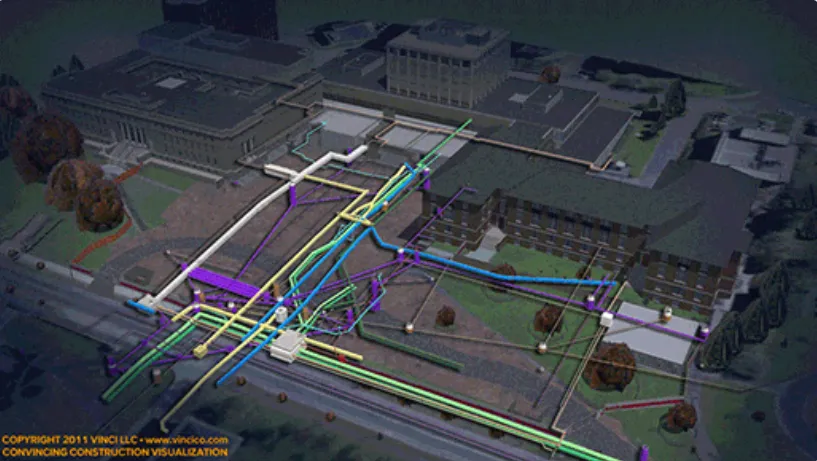

Construction, renovation, and infrastructure projects often need more than a single detection method to assess existing underground conditions. For many projects, professionals use a combination of utility locating, video pipe inspections, and digital mapping in order to establish subsurface morphology infrastructure and facilitate construction planning and execution. By integrating technologies, property owners, engineers, and contractors can have a better understanding of subsurface utilities and assess the limitations of each investigation.
Projects that involve mapping underground utilities in Washington often involve the combined use of utility locating services and video inspection technology. Utility locating teams document utility route information, which can be used to identify traversable pathways through pipe systems and to produce mapping deliverables.
Understanding the Role of Utility Mapping
Utility mapping is a process that converts field-located utility information into digital records. Before mapping begins, utilities must first be identified and marked using appropriate locating methods.
A typical workflow may include:
- Reviewing available utility records and site information
- Performing electromagnetic utility locating on accessible conductive utilities
- Conducting passive frequency sweeps for energized or signal-emitting utilities
- Applying supplemental methods when site conditions require additional investigation
- Marking identified utility routes
- Recording utility locations using GNSS, RTK, or other mapping technologies
When performing mapping underground utilities in Washington, technicians may collect information for utility lines, valves, manholes, vaults, pedestals, and other utility appurtenances. Depending on project requirements, deliverables may include PDF utility maps, CAD files, GIS-compatible data, KMZ files, or coordinate datasets.
It is important to recognize that mapping accuracy depends on factors such as site accessibility, satellite coverage, environmental conditions, and the methods used to collect data.
How Video Camera Inspections Support Utility Investigations
Video inspection technologies provide another source of information when evaluating underground infrastructure. Unlike utility mapping, which records surface locations of identified utilities, video inspections allow technicians to observe conditions inside accessible pipes and conduits.
Many projects requiring pipe camera services in Washington involve:
- Sewer camera inspections
- Drain camera inspections
- Push video camera inspections
- Video camera pipe inspections
- Conduit investigations
Before an inspection begins, technicians typically review project objectives, identify access points, and discuss expected deliverables with the client. Access may be provided through cleanouts, manholes, catch basins, vaults, or exposed conduit openings.
Equipment such as the Vivax VCam 6, Cues P540 Push Camera, Cues Mplus Push Camera, and GatorCam4 may be selected based on pipe size, accessibility, and project requirements.
Because inspection conditions vary, video quality and inspection range may be affected by debris, standing water, pipe configuration, access restrictions, and other operational limitations.
Using Pipe Locating to Verify Utility Routes
Video inspections often become even more valuable when combined with a pipe locating service in Washington. During certain inspections, technicians can track a traceable sonde attached to inspection equipment. This allows the surface route of an accessible pipe to be marked while the inspection progresses underground.
A typical process may involve:
- Identifying an appropriate access point.
- Inserting a camera or tracing device into the pipe.
- Tracking the sonde signal from the surface.
- Marking the pipe route at regular intervals.
- Recording depth estimates when site conditions allow.
- Documenting findings for client review.
This combination of inspection and locating methods can assist with documenting utility pathways that may not be visible from the surface.
However, depth estimates remain approximate and can vary because of soil conditions, signal distortion, utility material, and other field variables.
Combining Mapping, Inspection, and Locating Technologies
Many projects require multiple service applications rather than a single detection method. Technicians often evaluate site conditions and, with client approval, apply additional technologies when needed.
Examples include:
- Electromagnetic utility locating for conductive utilities
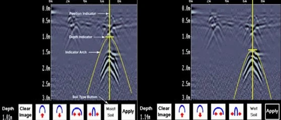
- Ground Penetrating Radar (GPR) for visible subsurface anomalies and nonconductive infrastructure
- Video camera inspections for internal pipe observations
- Acoustic pipe detection for certain pressurized non-metallic water lines
- Magnetic detection for ferrous utility components
- Digital utility mapping for documentation of located infrastructure
A pipe locating service may be needed for a project, including mapping underground utilities to document utility routes prior to producing mapping deliverables. Additionally, pipe camera services in Washington may be used to obtain further information to aid in field verification when accessible pipe is available for inspection.
No technology can register every utility or subsurface condition in all situations. Site and utility conditions, accessibility, utility materials, and environmental conditions all determine what information can be collected during an investigation.
Conclusion
Utility mapping, pipe inspections, and pipe locating are three different services with specific purposes. Combined correctly, these services may support contractors, engineers, property owners, and utility professionals in documenting and planning projects. All of these services are specific in applicability; yet, using more than one service will often overcome unique factors associated with certain projects and provide field information to support planning and the decision-making process. C-NI Locates Ltd. offers utility locating, inspection, and mapping services for projects in need of utility documentation, inspections, and subsurface investigations throughout the state of Washington.





















Sign in to leave a comment.