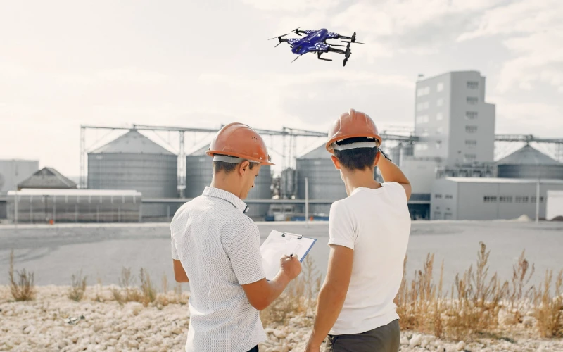
Have you ever stopped to watch a drone buzzing around a local park? Or maybe you’ve seen one filming a wedding or checking the roof of a neighbor’s house. It’s pretty cool technology, right?
It is undeniable that drones are popping up everywhere these days. But now, we aren't just using them for fun. We are using them to keep buildings from sinking, bridges from cracking, and roads from flooding.
At the very heart of this technology is a powerful process called “Terrain & Elevation Modeling.”
Now, imagine for a moment that you want to build your dream house. You hire a builder, they pour the concrete foundation, and they start framing the walls. But halfway through, they realize the ground is actually sloped, not flat.
Suddenly, one side of the house is sinking into the mud. Cracks start to appear in the drywall. Water pools in the basement every time it rains.
That would be a total disaster, wouldn't it?
That is why obtaining accurate elevation data matters so much. It helps engineers, architects, and builders make sure their projects are safe, level, and built to last. It turns the guesswork of the old days into the precision of the modern age.
What is Terrain & Elevation Modeling?
To really understand why this is such a game-changer, we need to talk about how we actually look at the ground.
In the construction and engineering world, we don't just say "the ground is bumpy." We have specific ways to describe the Earth. You might hear experts throwing around acronyms like DSM, DTM, and DEM.
If that sounds confusing, don't worry. Let’s break them down so that we may be able to easily understand them.
The Three Layers of the Land
DSM (Digital Surface Model).
Imagine you take a giant bedsheet and throw it over a whole city. The sheet would drape over everything: the trees, the cars parked on the street, the houses, the fences, and the ground itself.
A DSM is a 3D map that includes all those things. It captures the "surface" of the world exactly as the drone sees it from the sky. This is useful, but sometimes we need to see what lies underneath.
DTM (Digital Terrain Model).
This is a little different. Imagine you have a pair of magic glasses that let you see right through the trees and buildings. You ignore the cars and the houses, and you look only at the bare dirt underneath.
That is a DTM. It is what happens when we digitally "mow the lawn" and remove obstacles to see the earth itself.
DEM (Digital Elevation Model).
This acts as the master data file. It represents the elevation of that bare ground in a mathematical grid. It tells us, "At this exact spot, the ground is exactly 500 feet above sea level."
From Boots on the Ground to Eyes in the Sky
All of these pieces come together to create 3D elevation data and allow for surface reconstruction.
Before drones came along, creating these models was incredibly hard work.
Surveyors had to walk around massive fields carrying heavy tripods, measuring sticks, and GPS poles. We would have to walk to a spot, stick the pole in the ground, record a number, walk twenty feet, and do it again.
It was slow. It was dangerous, especially on steep cliffs. And honestly, it wasn't always perfect because we couldn't step on every single inch of the land.
Today, drone-based terrain mapping has changed everything — and if you want to see how it works in action, here’s a detailed guide on drone mapping
A drone can fly over that same field in thirty minutes. It captures millions of data points instead of just a few hundred. It does the job in a fraction of the time, but with way more detail.
This is the real power of geospatial intelligence: taking data from the air to make smart, safe decisions on the ground.
Importance of Accuracy in Modern Drone Surveying
We talk a lot about "accuracy" in this industry, but what does that actually mean?
For this line of work, accuracy isn't just about being "close enough." Being off by just a few inches can result in a catastrophe.
If a construction crew digs a trench for a pipe based on bad numbers, the water won't flow. If a developer calculates the amount of dirt they need to move and gets it wrong, it can cost the project tens of thousands of dollars in extra trucks and fuel.
This is where survey-grade accuracy comes into play.
When we say "survey-grade," it means that the data is trustworthy enough to build a skyscraper on. Because nobody wants a rough sketch, everybody needs to know exactly where things are, down to the centimeter.
To achieve this high level of trust, we often use RTK/PPK drone survey corrections. These are advanced systems that ensure our flying robots are tracking their position perfectly.
If we rely on inaccurate elevation models, big problems happen. For example:
- Water Issues
- Legal Disputes
- Safety Hazards
Industries like mining, construction, and city planning rely heavily on precise elevation data.
How Terrain & Elevation Modeling Enhances Accuracy
It isn't magic; it’s math and technology working together. Key benefits include:
- Precision in DEMs
- Better slope, gradient, and contour interpretation
- Error reduction with 3D reconstruction
- RTK/PPK GNSS integration
If you want to explore more about the 3D side of drone work, here’s a great resource on drone 3D scanning
Tools & Technology Used for Accurate Terrain Modeling
- RTK-enabled drones
- Photogrammetry software
- LiDAR mapping
- High point cloud density & aerial triangulation
Industry Use Cases
- Construction & Site Planning
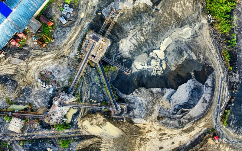
- Mining & Quarrying
- Agriculture
- Real Estate Development
- Environmental Projects
Common Challenges & How Terrain Modeling Solves Them
- Vegetation density
- Uneven terrain
- Weather interference
Conclusion
Terrain & Elevation Modeling isn't just a technical term — it's the foundation of safe, efficient, and accurate planning.
Do you need precise data for your next project?
Don't guess what the ground looks like. It is too risky and too expensive to be wrong.
Contact us today to request our professional drone surveying services.
Let us help you get the accuracy, safety, and peace of mind your project deserves.


Sign in to leave a comment.