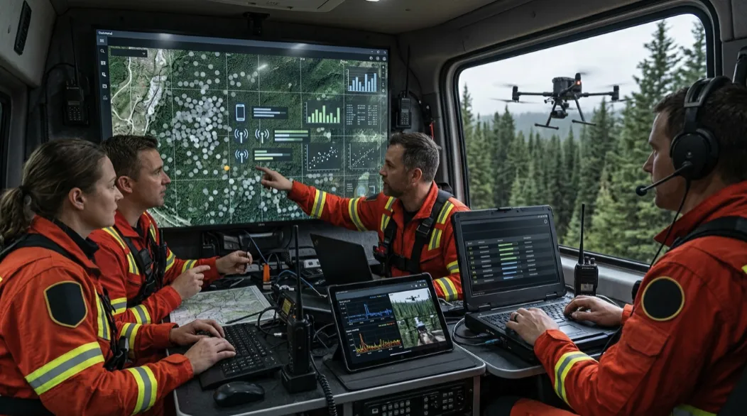

Modern Search & Rescue (SAR) operations face a common challenge: responders must make critical decisions with limited information, often across vast and difficult terrain. While drones, thermal cameras, GPS navigation, and ground search teams have significantly improved rescue capabilities, one technology is becoming increasingly valuable for helping teams narrow search areas—Radio Direction Finding (RDF).
Rather than replacing traditional SAR methods, RDF provides an additional source of operational intelligence by helping responders estimate the direction of detectable wireless signals. Platforms such as Live Aware's X•SAR demonstrate how RDF can be integrated with RF sensing, tactical mapping, mobile applications, and real-time dashboards to support better-informed Search & Rescue operations.
Learn more about Live Aware's Search & Rescue platform:
https://live-aware.com/sar-and-rescue/
Search & Rescue Is an Information Problem
Every Search & Rescue mission begins with uncertainty.
A missing hiker may have deviated from a trail. A vulnerable person may have become disoriented in a large park. Following a natural disaster, responders may need to search damaged buildings, flooded areas, or dense woodland where visibility is limited.
The challenge is rarely a lack of effort.
The challenge is knowing where to focus that effort first.
Emergency responders continuously gather information from multiple sources:
- Ground search teams
- Drone reconnaissance
- GPS tracking
- Witness reports
- Weather observations
- Thermal imaging
- Wireless signal detections
The more effectively these data sources work together, the more efficiently a search operation can progress.
Understanding Radio Direction Finding
Many people carry electronic devices that regularly transmit Bluetooth Low Energy (BLE) or Wi-Fi signals.
Examples include:
- Smartphones
- Smartwatches
- Fitness trackers
- Bluetooth headphones
- Other connected devices
RF sensing can detect these transmissions.
However, simply knowing that a signal exists does not necessarily help responders determine where to search.
Radio Direction Finding (RDF) adds another layer of intelligence by helping estimate the direction from which a signal appears to originate.
When responders collect measurements from different locations, they can compare signal behaviour and identify areas that deserve closer investigation.
Detection Alone Is Not Enough
Imagine receiving a wireless signal somewhere within a ten-square-kilometre search area.
Without additional context, responders still face a huge operational challenge.
Questions remain:
- Is the signal becoming stronger?
- Is it moving?
- Has it been detected before?
- Is it inside the assigned search boundary?
- Does it belong to a rescue worker?
RDF helps answer these questions by providing directional context rather than treating every signal as an isolated event.
This transforms wireless detections into information that can support operational planning.
Integrating RDF with Drone Operations
One of the most practical applications of RDF is its integration with UAV platforms.
Drones can quickly survey terrain that may be difficult or dangerous for ground teams to access.
As they move across the search area, they can collect:
- RF detections
- GPS coordinates
- Signal strength measurements
- Detection history
- Flight path information
Instead of relying on a single observation, operators can compare measurements from multiple positions.
This helps identify trends rather than isolated events.
A repeated detection that grows stronger along successive flight paths may justify redirecting ground teams to investigate the area more closely.
The Importance of Tactical Visualization
Operational data has limited value if it cannot be understood quickly.
Modern Search & Rescue platforms therefore emphasize visualization rather than raw technical output.
Examples include:
- Tactical maps
- Signal markers
- AI-assisted heatmaps
- Detection history
- Search boundaries
- Team positions
- Mission timelines
- Peak signal locations
By placing wireless detections within a geographic context, responders gain a clearer understanding of how information relates to the wider mission.
This supports faster and more confident operational decisions.
Coordinating Multiple Teams
Large Search & Rescue operations rarely involve a single responder.
They often include:
- Drone pilots
- Ground search teams
- Technical specialists
- Emergency medical personnel
- Incident Commanders
Maintaining a shared operational picture across all these roles is essential.
Live Aware's X•SAR combines an Android field application with a synchronized web dashboard, allowing field operators and command personnel to access consistent mission information.
Rather than relying solely on verbal updates, teams can review live operational intelligence through a common interface.
Reducing Operational Noise
Search environments often contain numerous wireless devices unrelated to the missing person.
These may include:
- Staff equipment
- Nearby vehicles
- Residential devices
- Public infrastructure
- Other visitors
Without filtering, responders could spend valuable time investigating irrelevant detections.
Modern SAR platforms address this through features such as:
- Whitelist management
- Device-category filtering
- Manufacturer filtering
- Signal-strength thresholds
- Geo-Fence controls
These tools help reduce unnecessary information while allowing responders to focus on higher-priority detections.
Privacy Must Remain a Priority
Any technology that processes wireless signals must also consider privacy.
Operational systems should collect only the information necessary to support legitimate Search & Rescue activities.
Live Aware follows a Privacy by Design philosophy, integrating privacy considerations into the platform from the beginning rather than treating them as an afterthought.
Responsible deployment builds trust while supporting effective emergency response.
Technology Supports Human Decision-Making
One of the most important principles of modern Search & Rescue is that technology should support—not replace—experienced responders.
RDF does not automatically locate missing people.
It does not eliminate uncertainty.
Instead, it helps emergency teams make better use of the information available to them.
Combined with thermal imaging, aerial observation, GPS mapping, witness reports, and ground searches, Radio Direction Finding provides another valuable perspective during complex rescue missions.
Looking Ahead
As Search & Rescue technology continues to evolve, greater integration between drones, RF sensing, Radio Direction Finding, AI-powered visualization, and collaborative mission management is likely.
Future platforms will not simply collect more information.
They will help responders understand information more effectively.
Solutions like Live Aware's X•SAR illustrate this direction by combining multiple operational technologies into a coordinated workflow that supports faster situational awareness and stronger mission coordination.
Conclusion
Radio Direction Finding is becoming an increasingly valuable capability within modern Search & Rescue because it helps transform wireless signal detections into actionable operational intelligence.
By estimating signal direction, supporting drone-based surveys, integrating tactical mapping, and synchronizing information across field teams and Incident Command, RDF can help reduce uncertainty during time-critical missions.
When combined with experienced responders and established SAR practices, technologies such as Live Aware's X•SAR demonstrate how modern operational platforms can improve coordination, prioritize search efforts, and help rescue teams make better-informed decisions when every minute counts.
Continue Reading
Explore how Live Aware combines Radio Direction Finding (RDF), RF sensing, UAV integration, tactical mapping, and real-time mission dashboards to support modern Search & Rescue operations:


























Sign in to leave a comment.