Introduction
Control points stand as the foundational reference markers employed in surveying to establish the framework for accurate measurements and data acquisition. These pivotal points serve as the linchpin for an array of surveying activities, encompassing topographic surveys, construction stakeouts, boundary assessments, and aerial mapping. The establishment of dependable control points is paramount to ensuring the exactitude, uniformity, and credibility of survey data. In this composition, we delve into the significance of Geographical survey companies in UAE and its indispensable role across diverse applications.
Unraveling Control Points
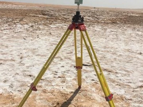
Control points, often dubbed survey control stations or markers, constitute distinct points on the Earth's surface with meticulously determined coordinates within a chosen coordinate system, often a geodetic reference framework such as the Global Positioning System (GPS) or local survey grids. These points serve as unchanging benchmarks that surveyors use to anchor and orient their measurements during field surveys. Control points offer a consistent and standardized framework that facilitates the accurate interconnection of multiple surveys – an essential facet for expansive projects spanning diverse locales or extended timeframes.
The Significance of Accurate Control Points
The precision in setting up accurate control points is of paramount significance in surveying, as all ensuing measurements and data harnessed during a survey pivot on these reference markers. Even minor deviations in the coordinates of control points can ripple through the entire survey, leading to notable inaccuracies in the eventual outcomes. High-precision control points emerge as unwavering foundations for an assortment of surveying methods and technologies, upholding the quality and dependability of the amassed data.
Approaches to Establishing Control Points
Several methodologies come into play when establishing control points, contingent upon the surveying project's scope, precision prerequisites, and available resources. A few common methodologies encompass:
GPS (Global Positioning System): Renowned for its global coverage and high precision, GPS technology plays a prevalent role in setting up Control Point Establishment. GPS receivers tap into satellite signals to ascertain accurate coordinates, facilitating efficient establishment over expansive terrains.
Total Station: This sophisticated surveying instrument integrates electronic distance measurement (EDM) with electronic theodolites. It excels in establishing control points within more localized zones that demand heightened precision.
Terrestrial Laser Scanning: Swiftly capturing millions of points, laser scanners prove ideal for creating detailed and densely populated control points.
Aerial Surveys: In extensive projects or vast areas, aerial surveys conducted via drones or aircraft expedite control point establishment.
Control Point Utility in Various Spheres
Control points find application across an array of surveying domains, including:
Topographic Surveys: Serving as reference benchmarks, control points enable accurate measurement and mapping of surface attributes within specific regions.
Construction Stakeouts: Well-defined control points aid in precise marking of intended structural and utility placements during construction endeavors.
Boundary Assessments: Plot demarcation company in UAE rely on control points to precisely ascertain property limits and create dependable cadastral maps.
Aerial Mapping: Control points lay the foundation for generating orthophotos and digital elevation models from aerial imagery.
Maintenance and Vigilance
Following control point establishment, their continual upkeep and monitoring emerge as pivotal to sustaining their enduring accuracy. Aspects such as land subsidence, tectonic shifts, and environmental dynamics can impact control point stability over time. Regular re-surveys and adjustments play a pivotal role in upholding control network integrity and ensuring the accuracy of subsequent surveys.
Conclusion
In summation, Plot demarcation company in UAE, furnishing the bedrock for precision measurements and dependable data accrual. The integration of advanced surveying technologies has expedited the creation of high-precision control points, rendering it more accessible and efficient than ever. The indispensability of control points spans diverse surveying applications, shaping successful ventures – from infrastructure development to environmental evaluations. Through a dedicated focus on the establishment and continual maintenance of accurate control points, surveyors can uphold the integrity and excellence of their surveying pursuits, facilitating informed decision-making and prosperous project outcomes.


Sign in to leave a comment.