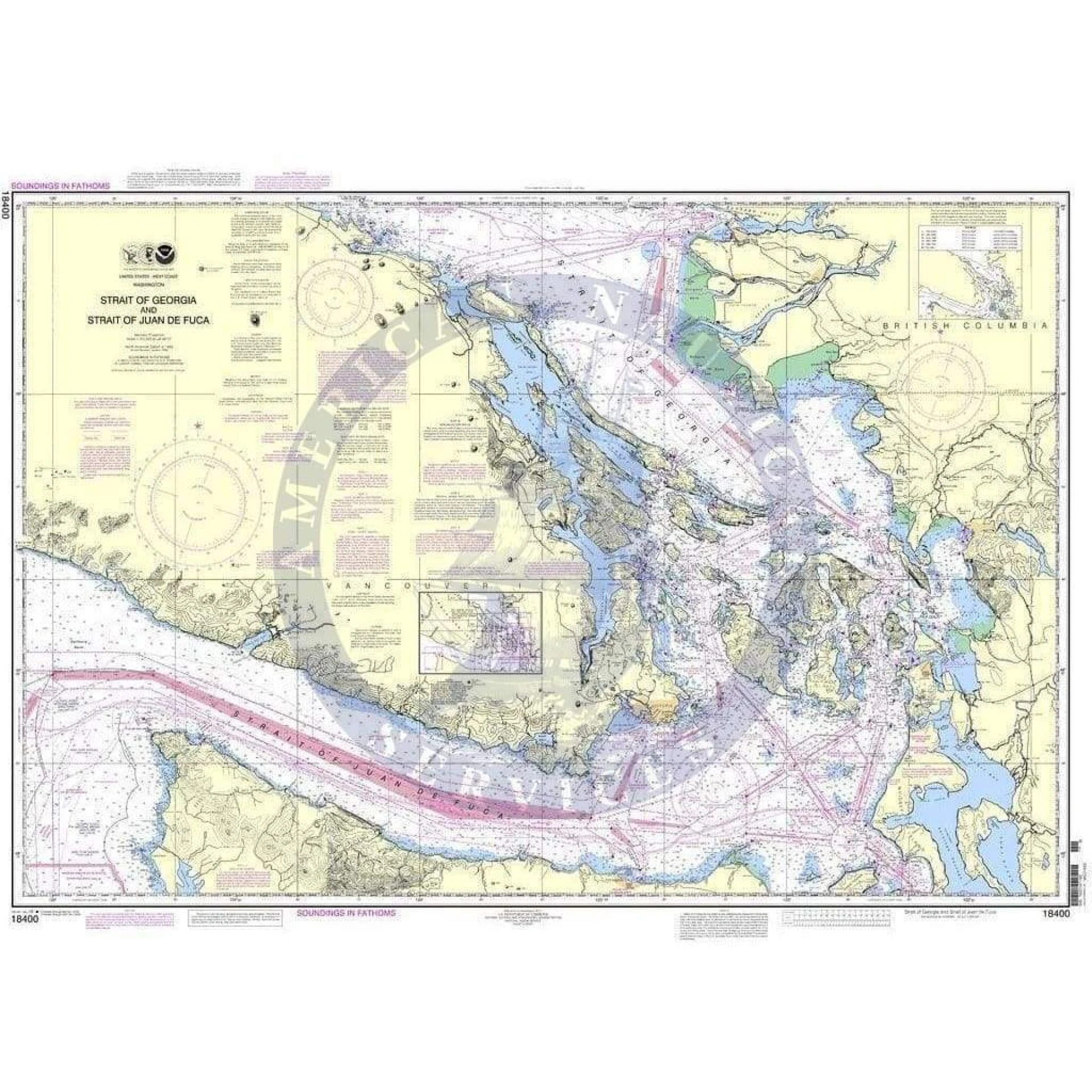
NOAA charts are official marine maps created by the National Oceanic and Atmospheric Administration. These charts show water depth, coastlines, hazards, and navigation aids. Mariners use them to travel safely on rivers, lakes, and oceans.
These charts are very important because they help avoid danger. Rocks, shallow water, and ship routes are clearly marked. Without proper charts, navigation becomes risky. That is why both beginners and experienced sailors trust NOAA charts for safe journeys.
Today, you can easily access updated noaa charts from trusted providers like American Nautical. These charts are reliable and meet global navigation standards.
Types of NOAA Charts You Should Know
There are different types of NOAA charts made for different uses. Each type serves a clear purpose.
- Raster Nautical Charts (RNCs)
These are scanned images of paper charts. They look like traditional maps. - Electronic Navigational Charts (ENCs)
These are digital charts used in modern navigation systems. - Paper Charts
Printed charts are still used as backups and for training. - Custom Charts
These allow users to select specific areas and print them.
Each type of NOAA charts helps mariners plan routes and stay safe. Choosing the right type depends on your navigation needs.
Key Features Found in NOAA Charts
Understanding the features of NOAA charts makes navigation easier and safer.
- Water depth and contour lines
- Navigation aids like buoys and lighthouses
- Shoreline details and landmarks
- Restricted and danger zones
- Tidal and current information
These features help sailors make smart decisions. For example, depth markings prevent ships from running aground. Navigation symbols guide vessels through safe routes.
How to Use NOAA Charts Effectively
Using NOAA charts correctly is important for safe travel. Here are simple tips to follow:
- Always check the latest updates before sailing
- Learn chart symbols and abbreviations
- Use charts along with GPS systems
- Keep a backup paper chart on board
- Plan your route in advance
You can find high-quality noaa charts from American Nautical to ensure accuracy and reliability. Updated charts reduce risks and improve navigation confidence.
Benefits of Using NOAA Charts
There are many benefits of using NOAA charts in marine navigation.
- Improve safety by showing hazards
- Help plan efficient routes
- Support legal and compliance needs
- Provide accurate and trusted data
- Work with both digital and paper systems
These advantages make NOAA charts a must-have tool for anyone on the water.
Frequently Asked Questions
What are NOAA charts used for?
NOAA charts are used for marine navigation. They show water depth, hazards, and safe routes.
Are NOAA charts free to use?
Yes, many digital NOAA charts are available for free, but printed and enhanced versions may cost money.
What is the difference between ENC and RNC charts?
ENC charts are digital and interactive, while RNC charts are scanned images of paper charts.
How often are NOAA charts updated?
NOAA charts are updated regularly to reflect changes in water depth, hazards, and navigation aids.
Can beginners use NOAA charts easily?
Yes, beginners can use them by learning basic symbols and navigation rules.
Where can I buy reliable NOAA charts?
You can buy trusted and updated NOAA charts from providers like American Nautical.
Final Thought
NOAA charts are essential tools for safe and smart navigation. They give clear and accurate information that helps mariners avoid risks and plan better routes. Whether you use digital or paper charts, having the right data makes a big difference. Choosing reliable sources like American Nautical ensures you always have accurate charts for every journey.


Sign in to leave a comment.