
Every successful project begins with one important question: What is already beneath the ground? From commercial developments and municipal upgrades to industrial expansions and public infrastructure improvements, understanding underground conditions before excavation can shape smarter planning from day one. While surface conditions may appear straightforward, buried pipelines and utility networks often tell a far more complex story. Through Pipeline Detection and Mapping, project teams gain valuable field observations that help build a clearer understanding of subsurface infrastructure before excavation, drilling, or construction activities begin. The result is not simply better documentation but greater confidence when making important project decisions.
Why does Underground Information Matter So Much?
Underground infrastructure is rarely static. Over decades, properties evolve as utilities are extended, rerouted, upgraded, or abandoned. Municipal improvements, private developments, emergency repairs, and renovations all contribute to a landscape that may differ significantly from original records.
Even well-maintained drawings cannot always reflect every modification made over the life of a property. As a result, relying solely on historical documentation can leave important questions unanswered before work begins. This is where utility detection plays an important role.
Rather than making assumptions based on visible conditions or archived plans, project teams can review documented field observations that provide additional insight into what may exist beneath the surface. These observations support informed planning while helping owners, consultants, municipalities, and construction professionals better understand existing underground infrastructure.
Utility locating contributes value across a wide range of projects, including:
- Commercial construction
- Municipal infrastructure improvements
- Industrial facilities
- Transportation projects
- Educational campuses
- Healthcare properties
- Residential developments
- Facility expansions
- Site redevelopment initiatives
No matter the project size, understanding existing underground conditions creates a stronger starting point for planning discussions.
More Than Simply Finding Buried Pipelines
Many people assume utility locating involves identifying the general path of a buried pipeline and marking the surface. In reality, the process often provides a much broader understanding of underground infrastructure.
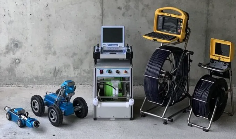
Professional Pipe Locating Services combine specialized detection technologies, available utility records, visible site features, and field observations to evaluate subsurface conditions. Depending on the project scope and environmental conditions, investigations may identify water lines, sanitary infrastructure, storm drainage, communication utilities, electrical services, gas utilities, abandoned pipelines, and other buried assets.
The value comes not only from gathering observations but from documenting them in ways that project teams can use throughout planning and construction.
Rather than relying solely on temporary markings, many projects benefit from maps, digital records, sketches, photographs, or other documentation that support future reference.
This organized information helps multiple participants communicate more effectively while reducing unnecessary uncertainty before excavation begins.
Can Project Drawings Tell The Entire Story?
Construction records remain valuable planning tools, but they rarely represent everything that has happened beneath a property over many years. A commercial building may have undergone several tenant improvements. A municipal corridor may have received multiple infrastructure upgrades. Industrial facilities often expand gradually as operational needs change.
Each modification has the potential to introduce underground infrastructure that differs from the original documentation. Even newer developments may include field adjustments made during construction that never appear on final drawings. Because of this, many organizations compare historical records with current field observations before excavation or redevelopment work begins.
This approach allows planning decisions to reflect both documented information and current site conditions, rather than relying exclusively on archived plans. The objective is not to replace project documentation but to complement it with additional observations gathered directly from the field.
When underground information is easier to understand, project discussions often become more productive.
Building Confidence For Future Projects
The benefits of utility locating frequently continue well beyond a single construction phase. Information gathered today can support tomorrow's maintenance planning, facility upgrades, future developments, and property management activities.
As organizations expand campuses, renovate existing facilities, or prepare for additional construction phases, previously documented underground observations often serve as valuable references that save time during future planning discussions.
For property owners managing multiple sites or municipalities coordinating long-term infrastructure improvements, maintaining organized utility documentation supports continuity across changing project teams and evolving facilities.
Organizations seeking a Pipe Locating Service in Washington often recognize that utility documentation represents an investment in future planning as much as present-day decision-making. Since underground environments continue to evolve over time, observations gathered during one investigation serve as practical reference material reflecting the conditions encountered during that specific assessment. Future projects can then begin with a stronger understanding of existing infrastructure rather than starting from scratch.
Well-documented underground information also supports collaboration among architects, designers, project managers, facility personnel, and construction teams by providing everyone with access to the same field observations. When conversations begin with better information, planning becomes more efficient, and decisions are based on documented site conditions instead of assumptions.
Conclusion
Confidence in any infrastructure project begins long before excavation equipment arrives. It starts with understanding the hidden environment beneath the surface and documenting existing conditions that can influence planning, scheduling, and future development. As a private utility locating company and utility detection and inspection service provider, CNI Locates LTD specializes in identifying and documenting subsurface infrastructure for public and private projects. By providing carefully documented field observations rather than installation, repair, excavation, or infrastructure certification, the company helps clients approach every project with greater awareness of what may exist below ground and a stronger foundation for informed decision-making.

















Sign in to leave a comment.