
Modern infrastructure projects generate enormous amounts of information, and collecting accurate field data has become just as important as designing the project itself. Engineers, surveyors, construction managers, and environmental consultants are increasingly relying on drone technology to monitor sites quickly, safely, and with exceptional precision. However, the real breakthrough isn't simply flying a drone—it's capturing meaningful data that supports better decisions.
This is where multispectral drone mapping stands apart from traditional aerial photography.
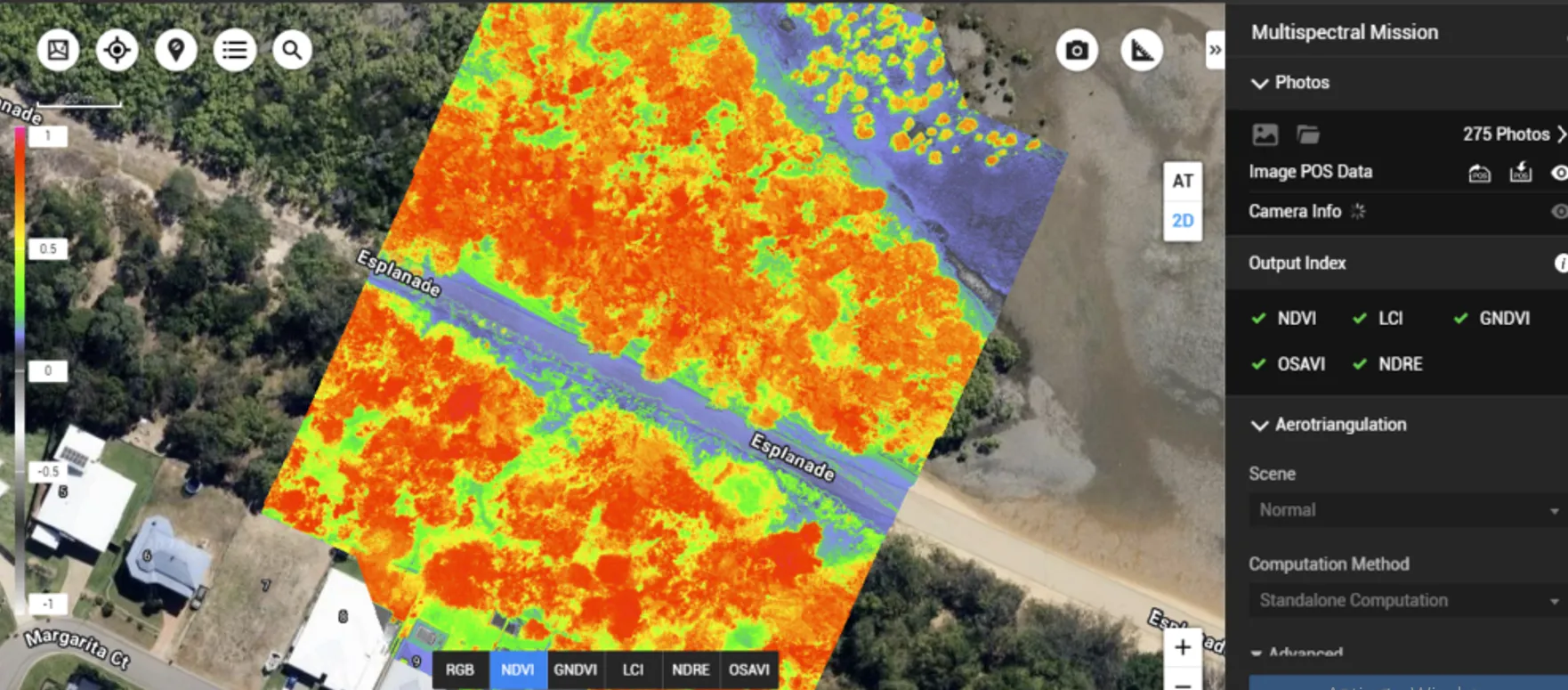
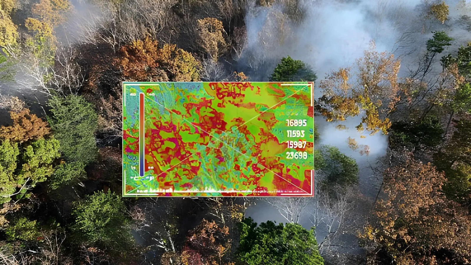
Unlike conventional RGB cameras that capture only visible colors, multispectral sensors record multiple bands of the electromagnetic spectrum, including near-infrared (NIR) and red-edge wavelengths. These additional measurements reveal information that cannot be detected by the human eye, making multispectral mapping an essential tool for modern surveying, environmental monitoring, construction planning, and infrastructure management.
What Is Multispectral Drone Mapping?
Multispectral drone mapping is the process of collecting aerial imagery across multiple spectral bands and converting that data into accurate geospatial information.
Instead of producing photographs alone, a multispectral survey creates datasets that allow professionals to analyze vegetation health, terrain conditions, surface materials, moisture variations, and environmental changes. The collected information can be integrated into Geographic Information Systems (GIS), engineering software, and digital twin platforms to support long-term planning.
The technology combines several disciplines, including drone surveying, photogrammetry, remote sensing, and data analytics, providing organizations with a comprehensive understanding of the areas they manage.
Why Standard Drone Photography Isn't Always Enough
Traditional drone photography is excellent for documenting visible site conditions. It can identify structural damage, measure dimensions, and produce high-resolution maps.
However, many problems develop long before they become visible.
For example, vegetation experiencing water stress may still appear healthy in an RGB image. Similarly, subtle environmental changes, drainage issues, or surface inconsistencies can remain hidden until they become costly problems.
Multispectral imagery captures these invisible patterns by measuring reflectance across different wavelengths. This allows professionals to identify changes early, helping organizations respond before issues escalate.
How Multispectral Data Is Collected
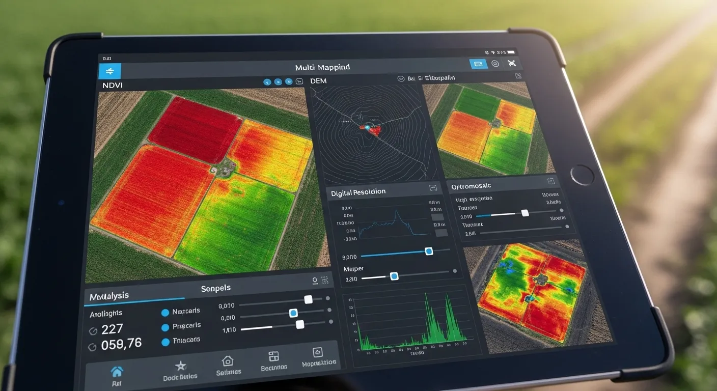
A successful mapping project follows a structured workflow.
The process begins with careful mission planning, where flight altitude, image overlap, weather conditions, and required ground resolution are determined. High-accuracy positioning systems such as RTK or PPK are often used to improve spatial accuracy.
During the flight, the multispectral sensor captures reflected sunlight from each surface. After the mission, specialized software processes thousands of overlapping images through photogrammetry.
The final deliverables may include:
- Orthomosaic maps
- Digital Surface Models (DSM)
- Digital Terrain Models (DTM)
- Point clouds
- Vegetation index maps
- GIS-ready datasets
- Three-dimensional models
These products provide decision-makers with accurate information instead of relying on visual interpretation alone.
Understanding Vegetation Indices
One of the greatest strengths of multispectral mapping is its ability to generate vegetation indices.
These mathematical models compare reflectance values from different spectral bands to evaluate plant health and environmental conditions.
Common indices include:
NDVI (Normalized Difference Vegetation Index) – Used for general vegetation health assessment.
NDRE (Normalized Difference Red Edge Index) – Detects early stress before visible symptoms appear.
GNDVI (Green Normalized Difference Vegetation Index) – Helps evaluate chlorophyll concentration.
SAVI (Soil Adjusted Vegetation Index) – Improves accuracy where exposed soil affects measurements.
Each index serves a different purpose, allowing professionals to choose the most appropriate analytical method for their project.
Industry Applications
Construction
Construction companies use multispectral drone mapping to monitor site progress, evaluate terrain conditions, document earthworks, and improve communication between project stakeholders.
Frequent aerial surveys create accurate historical records while reducing the need for repeated manual inspections.
Renewable Energy
Large solar farms and renewable energy facilities require continuous monitoring.
Drone mapping helps identify vegetation encroachment, monitor site conditions, and improve maintenance planning while minimizing inspection time.
Mining
Mining operations rely on accurate terrain information for planning and reporting.
Drone surveys provide stockpile measurements, volume calculations, and topographic models far more efficiently than many traditional methods.
Environmental Monitoring
Government agencies, environmental consultants, and conservation organizations use multispectral imagery to monitor wetlands, forests, vegetation health, erosion, and habitat conditions.
Because surveys can be repeated consistently, organizations gain valuable long-term environmental records.
Infrastructure Inspection
Roads, bridges, utility corridors, and pipelines often cover large geographic areas.
Drone mapping improves inspection efficiency while reducing the safety risks associated with manual fieldwork.
The Role of Artificial Intelligence
Artificial intelligence has become an important part of modern drone data processing.
Machine learning algorithms can analyze thousands of images, identify patterns, classify objects, and detect anomalies with remarkable speed.
Computer vision systems help identify infrastructure defects, monitor construction progress, and recognize changes between multiple surveys.
Combined with digital twin technology, AI enables organizations to compare historical conditions with current datasets, improving planning and predictive maintenance.
Why Data Quality Matters
High-quality results depend on more than advanced equipment.
Successful projects require:
- Proper flight planning
- Adequate image overlap
- Accurate positioning systems
- Sensor calibration
- Appropriate weather conditions
- Professional processing workflows
Ignoring these factors can significantly reduce the reliability of the final datasets.
For organizations making engineering or operational decisions, data quality is often more valuable than simply collecting additional imagery.
Looking Ahead
As industries continue adopting digital workflows, multispectral drone mapping is becoming an essential source of operational intelligence.
Instead of relying solely on visual observations, organizations can analyze measurable environmental and structural information, allowing them to detect issues earlier, improve planning, and allocate resources more effectively.
Professionals interested in learning more about practical use cases and industry-specific examples can explore this guide on multispectral drone applications.
Final Thoughts
Drone technology has evolved well beyond aerial photography. Modern multispectral sensors, combined with photogrammetry, GIS, artificial intelligence, and remote sensing, provide organizations with reliable information that supports smarter decisions.
Whether monitoring infrastructure, managing environmental projects, planning construction activities, or analyzing terrain conditions, multispectral drone mapping delivers insights that traditional imagery alone cannot provide.
As demand for accurate geospatial intelligence continues to grow, organizations that invest in high-quality drone data today will be better prepared to solve tomorrow's challenges.


























Sign in to leave a comment.