What is deformation monitoring?
Deformation monitoring is a methodical measurement and recording of any alteration in the shapes/dimensions of objects. This monitoring is a vital part of logging calculated values. These values are used for computation, analysis, maintenance and alarming.
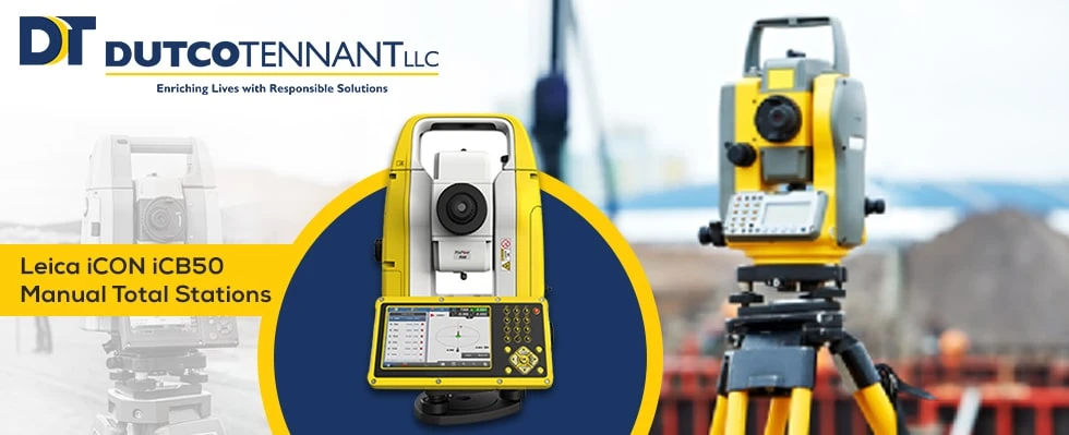
Deformation Monitoring relates to the genre of "Applied Surveying". It may relate to mechanical engineering, civil engineering and geology too. Reach out to Total Stations Supplier in UAE for enabling Total Station in your place.
The geodetic measuring tools measure and calculate georeferenced displacements in 1/2/3 dimensions. It consists of tools like Total stations, levels etc. The vital field tool to survey land is the total station. It is one of the flexible and best monitoring sensors. Each surveying service provider company has a total station.
Monitoring is continuous surveying of the same object and after that comparing results. Each surveyor needs to do this monitoring.
Total stations are effortlessly used for monitoring purposes. The frequent measurements can be easily finished manually. The changes in the positions of measurements can also be measured through various tools. But the benefits of owning a total station especially an automated one include - possibility for measuring automatically using apps. The Monitoring application executes in providing measurement plans. The app increases quality assurance and enhances productivity because of repeated and strategic workflow with incorporated data quality checks. The total stations nowadays are agglomerated with cloud visualization. The data measured can be presented/transferred from a mobile device just by standing in front of the tool.
Which kind of Geosystems surveys total stations be used for deformation monitoring? The answer is - Something that fulfils any projects' precision needs. The manual total stations stand for working within the manual workflows. But the automation capacities of a total station (TS) provide a much more adaptable and simple transition into automated monitoring.
The accuracy of measurements with total stations depends on three elements: a)The setup point, b) The measurement path c) The measurement target. The setup point consists of the tool itself, the firmness of the support, along with the things coming in the vicinity of the tool. The measurement path is affected by the atmospheric condition. It has an impact on the travelling speed of the signal. Next, the temperature gradients cause measurement paths' curvature. The last complicated element is the target. The precision of measurement depends on the target kinds like: a) rock b) inclination angle of measurement path(in respect with that of the target and the target object).
Experiments of the total station:
Few experiments were done with total stations. In those experiments, the atmospheric environment was calculated in precise detail. Even the images of targets were taken through the total station. Various measurement schemes were also put into a try.
Types of precision in total stations:
A usual total station can calculate - Distance (Maximum 1500 metres that is 4900 feet with a precision of around 1.5 millimetres/million. The reflectorless stations can calculate distances to that object even of light colour (a few 100 meters.
Total Stations Monitoring
The difference between monitoring total station and surveying instrument lies - both are made for 24/7 monitoring purposes in an automatic way. When configured and agglomerated with monitoring software once, then the total stations can do measurement constantly without any human hand.
The vital requirements are:
The mechanical design of total stations should permit them to combat rough conditions with 100% stability even at the time of largest maintenance interval timings. They require that much intelligence to adapt automatically to a continuously changing environment. It is only for achieving a large number of successful measurements.The multi-station:
It is sometimes not possible for various reasons to keep prisms in areas to get monitored such as roads, historical buildings etc. Due to multi-station scanning capacity increased. The geosystems are all-rounder surveying instruments. The same place gets repeatedly scanned through a precise measurement tool. Every scan is compared to that of the reference scan. Thus the deformation is measured. The software performs the work automatically. You can watch the results as a graph or table, heat map etc. It displays cloud statistical values of median deformation, deformation volume, maximum deformation.
Why is monitoring needed?
The cities are constantly growing and construction is too fast. The safety of equipment, as well as people, has become more complicated. Therefore the demand for deforming monitoring is also continuously growing. Grow your surveying business with the monitoring tools.In conclusion, we will like to say highly accurate/precise measurements can be achieved by total stations but with a sound knowledge of errors (if any). The advantages of total stations of quick collection, multiple surveys, hassle-free horizontal measurements, are perfect for deformation monitoring. The layout of the tools in any construction site is efficient and fast. Without any further thought install the total stations for your place by availing the services of Total Stations Supplier in UAE.


Sign in to leave a comment.