

Every transportation model, master plan, and signal timing decision across the UAE ultimately rests on one thing: accurate, ground-truth data about how vehicles, pedestrians, and cyclists actually move through a given road network. Traffic Surveys are the fieldwork that generates that data, feeding everything from a single intersection redesign to a nationwide rail demand model with the counts and movement patterns planners cannot reliably estimate any other way.
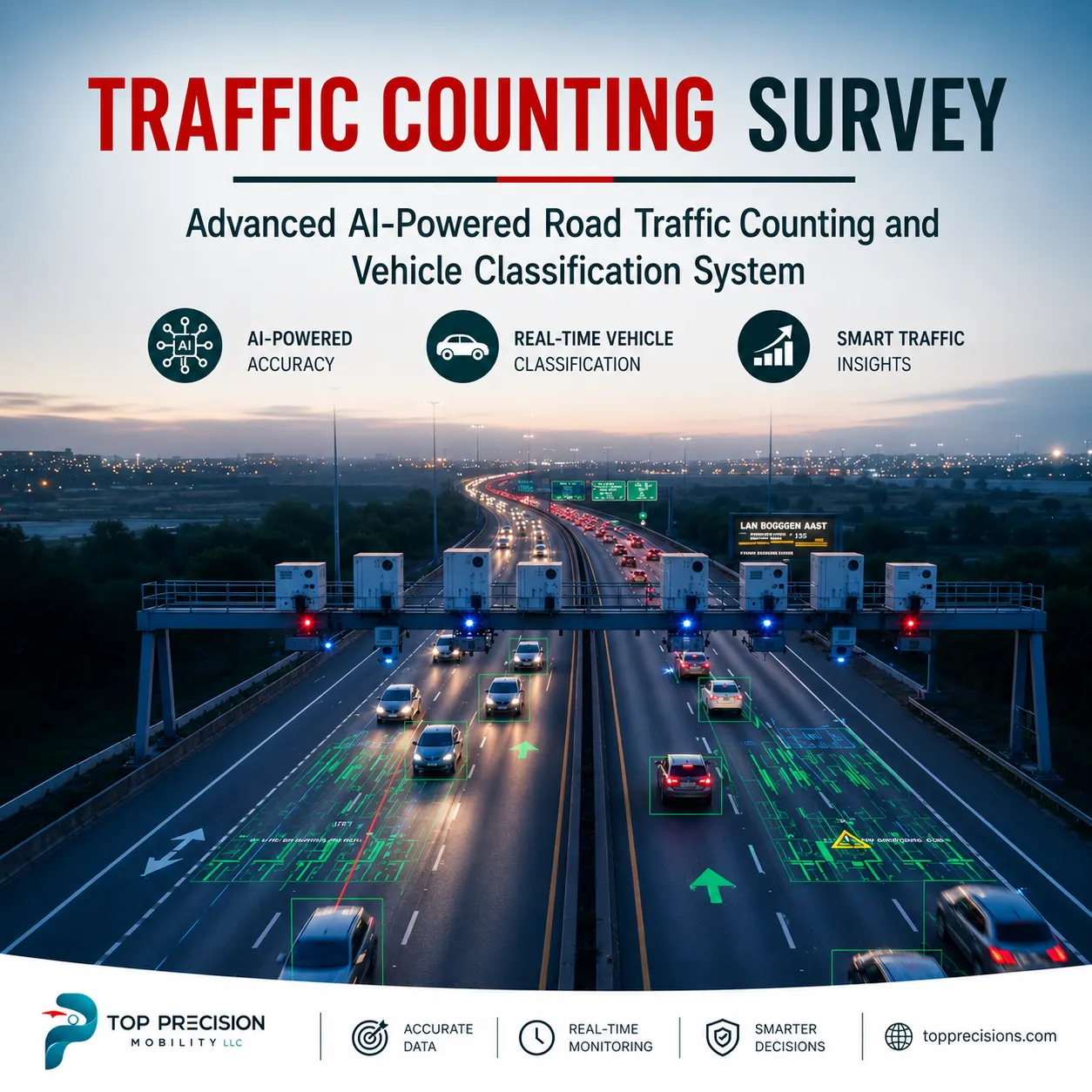
As the UAE continues expanding its road, rail, and micro-mobility infrastructure at a pace few other markets match, the quality of the underlying survey data has become a genuine differentiator between transportation plans that hold up under real-world conditions and those that don't. A model is only as good as the field data feeding it, which is exactly why authorities and engineering consultancies increasingly scrutinize survey methodology as closely as the modeling software itself.
Why Ground-Truth Data Still Matters in an Age of Predictive Modeling
It might seem like sophisticated traffic modeling software should reduce the need for extensive field surveys, but the opposite is closer to true — better models simply demand better input data. A transportation model built on outdated or thin survey data will produce confident-looking outputs that quietly diverge from reality, a gap that typically doesn't surface until infrastructure is already built and traffic patterns don't match what the model predicted.
This is why major UAE infrastructure programmes — rail demand studies, citywide strategic transportation plans, emirate-wide model updates — consistently commission fresh, large-scale field surveys rather than relying on historical data or estimation alone. The fieldwork itself has become recognized as a critical risk factor in programme delivery, not simply a routine data-gathering formality.
Automated Traffic Counts (ATC): The Foundation of Volume Data
At the most basic level, Automated Traffic Counts (ATC) use camera or sensor-based systems installed at a road segment to continuously record vehicle volumes over an extended period, typically 24 hours or longer, without requiring a field enumerator to manually tally vehicles in real time. This automation allows survey teams to capture data around the clock, including overnight and off-peak periods that a manual count would struggle to cover cost-effectively.
The reliability of ATC data depends heavily on correct installation — cameras and sensors need to be positioned to capture a clear, unobstructed view of the full carriageway, calibrated for the specific road geometry, and mounted securely enough to withstand extended outdoor deployment across the UAE's climate conditions without data quality degrading over the survey period.
Classified Vehicle Counts: Understanding the Traffic Mix, Not Just the Volume
Raw vehicle volume alone tells only part of the story. Classified Vehicle Counts break down traffic into categories — passenger cars, buses, trucks, motorcycles — giving planners the composition data essential for pavement design, freight corridor planning, and public transport capacity decisions that a simple volume count could never support on its own.
This classification becomes particularly important for freight and logistics-focused studies, where understanding what proportion of a corridor's traffic is heavy commercial vehicles directly informs decisions about road wear, weight restrictions, and dedicated freight lane planning that pure volume data would leave planners guessing about.
Turning Movement Counts (TMC): Mapping How Traffic Actually Flows Through Intersections
While ATC captures volume along a road segment, Turning Movement Counts (TMC) record exactly how traffic moves through an intersection — how many vehicles turn left, right, or continue straight from each approach — data that feeds directly into signal timing optimization, intersection capacity analysis, and junction redesign decisions.
TMC data collection is typically conducted at peak and off-peak periods specifically, since turning patterns and volumes shift considerably between a morning commute period and a midday off-peak window, and a signal timing plan optimized for one period without accounting for the other will underperform during whichever period wasn't properly surveyed.
Pedestrian & Cyclist Counts: Filling the Gap Vehicle-Focused Surveys Leave Behind
As UAE cities invest more heavily in walkability and cycling infrastructure, Pedestrian & Cyclist Counts have become essential complements to traditional vehicle surveys, capturing footfall and cycling volumes at crossings, along corridors, and around transit stations that inform everything from crossing signal timing to dedicated bike lane sizing.
This data carries particular weight for projects like pedestrian bridges and tunnels, where accurately sizing the infrastructure depends entirely on knowing actual pedestrian volumes at specific locations and times — data that generic assumptions or nearby proxy locations simply cannot substitute for reliably.
Micro-Mobility Counts: Capturing a Rapidly Growing Traffic Category
E-scooters, e-bikes, and other micro-mobility vehicles represent one of the fastest-growing categories of urban movement across UAE cities, and Micro-Mobility counts capture this traffic specifically, feeding into master planning studies aimed at safely integrating these vehicles into existing road and pedestrian infrastructure rather than treating their growth as an afterthought.
Because micro-mobility usage patterns differ considerably from both traditional vehicle and pedestrian traffic — different speeds, different route preferences, different peak periods — dedicated counting methodology tailored to this specific category produces considerably more useful planning data than attempting to extrapolate it from existing pedestrian or cyclist count data alone.
ATC & TMC Camera Installation: Where Data Quality Actually Begins
The accuracy of every downstream data point traces back to how well ATC & TMC Camera systems are installed in the field. Proper installation at intersections, junctions, and roundabouts requires positioning that captures every approach clearly, mounting secure enough to withstand extended outdoor deployment, and setup compliant with local road safety standards for equipment installed near live traffic.
Field teams handling this installation work need genuine technical competence beyond simply mounting a camera — correctly configuring capture angles for automated vehicle classification, ensuring continuous power and connectivity for extended recording periods, and troubleshooting on-site issues quickly enough that a survey period isn't compromised by equipment downtime.
Key Benefits of Professional Traffic Survey Data for UAE Infrastructure Projects
Authorities, developers, and engineering consultancies commissioning rigorous traffic surveys typically realize benefits across several practical areas:
- Transportation models grounded in real, current field data rather than estimation
- Signal timing and intersection designs based on actual turning movement patterns
- Infrastructure sizing decisions supported by genuine pedestrian and cyclist volume data
- Freight and logistics planning informed by accurate vehicle classification data
- Reduced project risk through quality-assured, geotagged, and timestamped field data
- Faster stakeholder confidence through transparent, real-time survey progress visibility
Quality Assurance: The Difference Between Raw Counts and Decision-Ready Data
Raw field data is only useful once it has passed through rigorous validation — checking for enumerator error, sensor miscounts, anomalies caused by equipment malfunction, and gaps in coverage that could otherwise silently undermine a transportation model built on the resulting dataset. Modern survey operations increasingly apply AI-assisted anomaly detection alongside traditional supervisor review to catch these issues before data ever reaches the client.
Geotagging and timestamping every data point have also become standard practice for serious survey operations, creating an auditable trail that lets a client or reviewing consultancy verify exactly where and when each count was taken — a level of traceability that distinguishes a professionally run survey programme from an informal or under-resourced one.
Traffic Surveys UAE: Supporting the Country's Major Infrastructure Programmes
Deploying Traffic Surveys UAE-wide increasingly means supporting genuinely large-scale infrastructure programmes — national rail demand modeling, citywide strategic transportation plans, and emirate-wide model updates that require survey teams capable of mobilizing significant field capacity within tight programme timelines.
This scale requirement has raised the bar for what a credible survey partner needs to demonstrate — a trained, multilingual enumerator workforce large enough to deliver high-volume fieldwork within fixed deadlines, alongside the technology infrastructure to manage, validate, and report on that volume of data without quality slipping as scale increases.
Traffic Surveys Dubai: Feeding the Emirate's Strategic Transportation Vision
Dubai's ongoing strategic transportation planning, including major citywide plans looking ahead to 2040, depends on exactly the kind of granular, multimodal field data Traffic Surveys Dubai programmes generate — household travel behaviour, roadside interviews, and automated traffic counts combined to build a comprehensive picture of how the emirate's population actually moves, rather than how planners might assume they move.
For consultancies and authorities working on Dubai-specific studies, working with a survey partner already prequalified with relevant local authorities — and with a demonstrated track record on comparable citywide programmes — considerably reduces both procurement friction and delivery risk compared to onboarding an unproven or unfamiliar field team.
Typical Traffic Survey Programme Workflow
A well-run traffic survey programme generally follows a structured methodology from initial planning through final reporting.
1. Site assessment and planning: identifying count locations, junction approaches, and appropriate survey periods.
2. Camera and sensor installation: safe, standards-compliant setup at intersections, junctions, and roundabouts.
3. Data capture: continuous, geotagged, timestamped recording of volumes, classifications, and movements.
4. Extraction and counting: automated and video-based processing to tabulate volumes and turning movements.
5. Validation and QA/QC: AI-assisted anomaly detection paired with supervisor review for reliable counts.
A final analysis and reporting stage then translate validated counts into peak-hour factors, signal timing inputs, and policy-ready reports, typically delivered alongside live dashboards that let stakeholders track survey progress and data quality throughout the fieldwork period rather than waiting until final delivery to see results.
Technology Behind Modern Traffic Survey Delivery
Contemporary traffic survey operations increasingly rely on an integrated technology stack spanning field data collection tools, GIS mapping platforms, and precision positioning technology like RTK GNSS and LiDAR for spatial accuracy, alongside dashboard and analytics platforms that turn raw field data into the visualizations planners and stakeholders actually use for decision-making.
This is where Top Precision Mobility's traffic survey capabilities stand out for UAE transportation programmes — the team combines CAPI-based field collection, GIS and mapping integration, and AI-assisted quality control into live-monitored survey operations, giving authorities and consultancies real-time visibility into fieldwork progress rather than a black-box process that only surfaces results at the end.
What Authorities and Consultancies Should Look for in a Survey Partner
Organizations commissioning traffic survey fieldwork should prioritize a partner with demonstrated prequalification or approval from relevant local transportation authorities, since this credential typically reflects a level of vetting a bid team can rely on ahead of contract award. A genuine track record on comparable large-scale programmes — rail demand studies, citywide strategic plans, emirate-wide model updates — is a meaningful indicator of a partner's ability to mobilize field capacity reliably.
Real-time monitoring and quality assurance capability should also factor heavily into vendor selection, since a survey programme that only reveals data quality issues after fieldwork concludes leaves considerably less room to correct course than one offering live visibility throughout the collection period.
Why UAE Transportation Programmes Trust Top Precision Mobility
Top Precision Mobility has delivered traffic and passenger survey fieldwork supporting major UAE transportation programmes, including rail demand modeling work alongside international engineering consultancies, citywide strategic transportation planning studies, and emirate-wide transportation model updates. The team is prequalified with the Dubai Statistics Center and Digital Dubai for survey and data-collection services, and holds approvals from other regional transportation authorities.
For authorities, developers, and consultancies across Dubai and the wider Emirates evaluating professional traffic survey and data collection services, this track record on genuinely large-scale, high-stakes UAE infrastructure programmes translates into a survey partner capable of mobilizing quickly and delivering quality-assured data within the tight timelines major transportation studies typically demand.
Conclusion
Traffic Surveys remain the ground-truth foundation every UAE transportation model depends on. Automated Traffic Counts (ATC), Classified Vehicle Counts, and Turning Movement Counts (TMC) capture how vehicles move, while Pedestrian & Cyclist Counts and Micro-Mobility counts fill the gaps vehicle data leaves behind, all supported by proper ATC & TMC Camera installation, driving demand for rigorous Traffic Surveys UAE and Traffic Surveys Dubai programmes.
FAQs
1. What is the difference between an Automated Traffic Count and a Turning Movement Count?
An ATC records overall vehicle volume along a road segment continuously over time, while a TMC specifically captures how vehicles move through an intersection — how many turn left, right, or go straight from each approach.
2. Why do transportation studies need classified vehicle counts instead of just total volume?
Classified counts break traffic down by vehicle type, giving planners the composition data needed for pavement design, freight planning, and public transport capacity decisions that a raw volume figure cannot support.
3. How are pedestrian and cyclist counts used in infrastructure planning?
They inform crossing signal timing, dedicated bike lane sizing, and infrastructure like pedestrian bridges, where accurate volume data at specific locations and times is essential for correct sizing.
4. What quality checks are applied to traffic survey data?
Reputable survey operations combine AI-assisted anomaly detection with supervisor review, along with geotagging and timestamping every data point, to catch enumerator or equipment errors before data reaches the client.
5. How long does a typical traffic survey programme take?
Timelines depend on the number of locations and survey periods required, but ATC and TMC data collection commonly runs for 24 hours or longer per location to capture both peak and off-peak patterns.






























Sign in to leave a comment.